You are here: Home > Network List > US - United States National Seismic Network Stations List
> Station EGMT Eagleton, Montana, USA > Earthquake Result Viewer
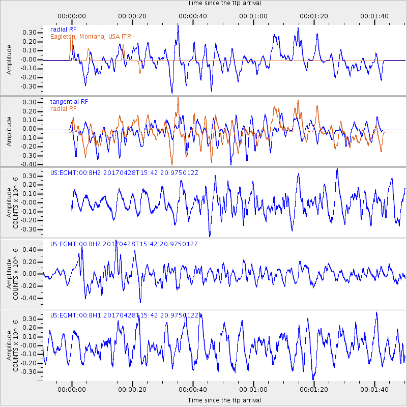
EGMT Eagleton, Montana, USA - Earthquake Result Viewer
*The percent match for this event was below the threshold and hence no stack was calculated.
| Earthquake location: |
Near Coast Of Central Chile |
| Earthquake latitude/longitude: |
-33.2/-72.0 |
| Earthquake time(UTC): |
2017/04/28 (118) 15:30:05 GMT |
| Earthquake Depth: |
20 km |
| Earthquake Magnitude: |
5.9 Mww |
| Earthquake Catalog/Contributor: |
NEIC PDE/us |
|
| Network: |
US United States National Seismic Network |
| Station: |
EGMT Eagleton, Montana, USA |
| Lat/Lon: |
48.02 N/109.75 W |
| Elevation: |
1055 m |
|
| Distance: |
87.7 deg |
| Az: |
335.708 deg |
| Baz: |
149.1 deg |
| Ray Param: |
$rayparam |
*The percent match for this event was below the threshold and hence was not used in the summary stack. |
|
| Radial Match: |
56.18764 % |
| Radial Bump: |
400 |
| Transverse Match: |
61.423176 % |
| Transverse Bump: |
400 |
| SOD ConfigId: |
2028011 |
| Insert Time: |
2017-05-12 15:38:56.303 +0000 |
| GWidth: |
2.5 |
| Max Bumps: |
400 |
| Tol: |
0.001 |
|
Signal To Noise
| Channel | StoN | STA | LTA |
| US:EGMT:00:BHZ:20170428T15:42:20.975012Z | 2.808121 | 2.1287288E-7 | 7.580616E-8 |
| US:EGMT:00:BH1:20170428T15:42:20.975012Z | 0.9369759 | 1.3350746E-7 | 1.4248761E-7 |
| US:EGMT:00:BH2:20170428T15:42:20.975012Z | 1.4766666 | 1.2234335E-7 | 8.285103E-8 |
| Arrivals |
| Ps | |
| PpPs | |
| PsPs/PpSs | |


