You are here: Home > Network List > TA - USArray Transportable Network (new EarthScope stations) Stations List
> Station G31M Satah River, YT, CAN > Earthquake Result Viewer
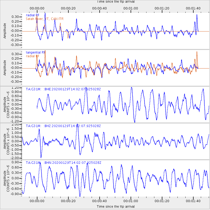
G31M Satah River, YT, CAN - Earthquake Result Viewer
*The percent match for this event was below the threshold and hence no stack was calculated.
| Earthquake location: |
Solomon Islands |
| Earthquake latitude/longitude: |
-10.4/161.3 |
| Earthquake time(UTC): |
2020/01/29 (029) 13:49:50 GMT |
| Earthquake Depth: |
87 km |
| Earthquake Magnitude: |
6.0 Mww |
| Earthquake Catalog/Contributor: |
NEIC PDE/us |
|
| Network: |
TA USArray Transportable Network (new EarthScope stations) |
| Station: |
G31M Satah River, YT, CAN |
| Lat/Lon: |
66.92 N/134.27 W |
| Elevation: |
61 m |
|
| Distance: |
89.8 deg |
| Az: |
20.834 deg |
| Baz: |
242.579 deg |
| Ray Param: |
$rayparam |
*The percent match for this event was below the threshold and hence was not used in the summary stack. |
|
| Radial Match: |
63.57419 % |
| Radial Bump: |
400 |
| Transverse Match: |
51.86309 % |
| Transverse Bump: |
400 |
| SOD ConfigId: |
20465011 |
| Insert Time: |
2020-02-12 14:01:37.641 +0000 |
| GWidth: |
2.5 |
| Max Bumps: |
400 |
| Tol: |
0.001 |
|
Signal To Noise
| Channel | StoN | STA | LTA |
| TA:G31M: :BHZ:20200129T14:02:07.925028Z | 2.7218063 | 8.461735E-7 | 3.1088675E-7 |
| TA:G31M: :BHN:20200129T14:02:07.925028Z | 1.5047114 | 4.7845145E-7 | 3.1796893E-7 |
| TA:G31M: :BHE:20200129T14:02:07.925028Z | 2.0131323 | 6.371895E-7 | 3.1651643E-7 |
| Arrivals |
| Ps | |
| PpPs | |
| PsPs/PpSs | |


