You are here: Home > Network List > UU - University of Utah Regional Network Stations List
> Station CCUT Cedar City, UT, USA > Earthquake Result Viewer
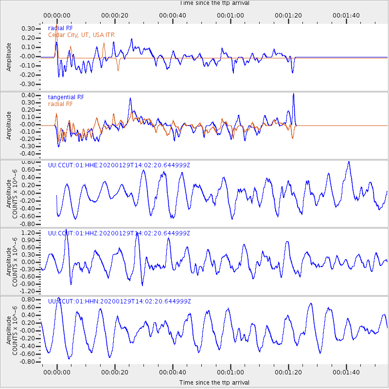
CCUT Cedar City, UT, USA - Earthquake Result Viewer
*The percent match for this event was below the threshold and hence no stack was calculated.
| Earthquake location: |
Solomon Islands |
| Earthquake latitude/longitude: |
-10.4/161.3 |
| Earthquake time(UTC): |
2020/01/29 (029) 13:49:50 GMT |
| Earthquake Depth: |
87 km |
| Earthquake Magnitude: |
6.0 Mww |
| Earthquake Catalog/Contributor: |
NEIC PDE/us |
|
| Network: |
UU University of Utah Regional Network |
| Station: |
CCUT Cedar City, UT, USA |
| Lat/Lon: |
37.55 N/113.36 W |
| Elevation: |
2127 m |
|
| Distance: |
92.6 deg |
| Az: |
52.466 deg |
| Baz: |
259.004 deg |
| Ray Param: |
$rayparam |
*The percent match for this event was below the threshold and hence was not used in the summary stack. |
|
| Radial Match: |
43.777065 % |
| Radial Bump: |
400 |
| Transverse Match: |
42.040676 % |
| Transverse Bump: |
400 |
| SOD ConfigId: |
20465011 |
| Insert Time: |
2020-02-12 14:03:28.393 +0000 |
| GWidth: |
2.5 |
| Max Bumps: |
400 |
| Tol: |
0.001 |
|
Signal To Noise
| Channel | StoN | STA | LTA |
| UU:CCUT:01:HHZ:20200129T14:02:20.644999Z | 2.522696 | 5.88128E-7 | 2.3313471E-7 |
| UU:CCUT:01:HHN:20200129T14:02:20.644999Z | 1.9117916 | 5.666165E-7 | 2.9637985E-7 |
| UU:CCUT:01:HHE:20200129T14:02:20.644999Z | 1.5975078 | 4.0535176E-7 | 2.5374007E-7 |
| Arrivals |
| Ps | |
| PpPs | |
| PsPs/PpSs | |


