You are here: Home > Network List > TJ - Tajikistan National Seismic Network Stations List
> Station GARM Garm, Tajikistan > Earthquake Result Viewer
GARM Garm, Tajikistan - Earthquake Result Viewer

| Earthquake location: |
Dodecanese Islands, Greece |
| Earthquake latitude/longitude: |
35.2/27.8 |
| Earthquake time(UTC): |
2020/01/30 (030) 11:21:37 GMT |
| Earthquake Depth: |
10 km |
| Earthquake Magnitude: |
5.8 mww |
| Earthquake Catalog/Contributor: |
NEIC PDE/us |
|
| Network: |
TJ Tajikistan National Seismic Network |
| Station: |
GARM Garm, Tajikistan |
| Lat/Lon: |
39.00 N/70.32 E |
| Elevation: |
1305 m |
|
| Distance: |
33.9 deg |
| Az: |
70.805 deg |
| Baz: |
277.124 deg |
| Ray Param: |
0.078017876 |
| Estimated Moho Depth: |
18.5 km |
| Estimated Crust Vp/Vs: |
1.60 |
| Assumed Crust Vp: |
6.306 km/s |
| Estimated Crust Vs: |
3.941 km/s |
| Estimated Crust Poisson's Ratio: |
0.18 |
|
| Radial Match: |
86.047966 % |
| Radial Bump: |
343 |
| Transverse Match: |
73.97958 % |
| Transverse Bump: |
400 |
| SOD ConfigId: |
20465011 |
| Insert Time: |
2020-02-16 10:06:50.268 +0000 |
| GWidth: |
2.5 |
| Max Bumps: |
400 |
| Tol: |
0.001 |
|
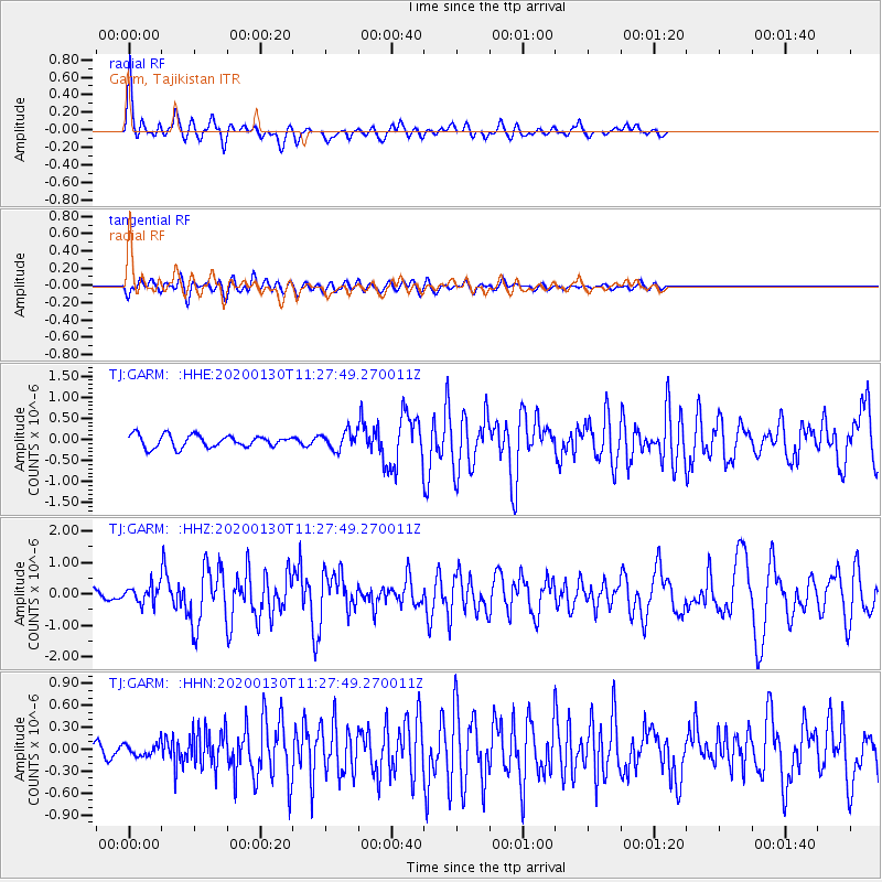
Signal To Noise
| Channel | StoN | STA | LTA |
| TJ:GARM: :HHZ:20200130T11:27:49.270011Z | 1.8113735 | 2.722612E-7 | 1.5030649E-7 |
| TJ:GARM: :HHN:20200130T11:27:49.270011Z | 0.8620952 | 7.952382E-8 | 9.224483E-8 |
| TJ:GARM: :HHE:20200130T11:27:49.270011Z | 1.4060895 | 2.0392254E-7 | 1.4502814E-7 |
| Arrivals |
| Ps | 1.9 SECOND |
| PpPs | 7.0 SECOND |
| PsPs/PpSs | 8.9 SECOND |


