You are here: Home > Network List > US - United States National Seismic Network Stations List
> Station DGMT Dagmar, Montana, USA > Earthquake Result Viewer
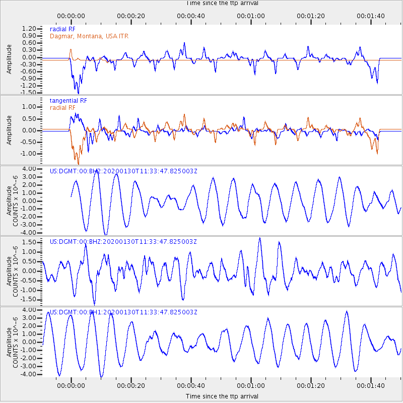
DGMT Dagmar, Montana, USA - Earthquake Result Viewer
*The percent match for this event was below the threshold and hence no stack was calculated.
| Earthquake location: |
Dodecanese Islands, Greece |
| Earthquake latitude/longitude: |
35.2/27.8 |
| Earthquake time(UTC): |
2020/01/30 (030) 11:21:37 GMT |
| Earthquake Depth: |
10 km |
| Earthquake Magnitude: |
5.8 mww |
| Earthquake Catalog/Contributor: |
NEIC PDE/us |
|
| Network: |
US United States National Seismic Network |
| Station: |
DGMT Dagmar, Montana, USA |
| Lat/Lon: |
48.47 N/104.20 W |
| Elevation: |
0.0 m |
|
| Distance: |
86.3 deg |
| Az: |
330.295 deg |
| Baz: |
37.562 deg |
| Ray Param: |
$rayparam |
*The percent match for this event was below the threshold and hence was not used in the summary stack. |
|
| Radial Match: |
48.95093 % |
| Radial Bump: |
352 |
| Transverse Match: |
71.45492 % |
| Transverse Bump: |
323 |
| SOD ConfigId: |
20465011 |
| Insert Time: |
2020-02-16 10:23:41.486 +0000 |
| GWidth: |
2.5 |
| Max Bumps: |
400 |
| Tol: |
0.001 |
|
Signal To Noise
| Channel | StoN | STA | LTA |
| US:DGMT:00:BHZ:20200130T11:33:47.825003Z | 2.958419 | 7.2006026E-7 | 2.433936E-7 |
| US:DGMT:00:BH1:20200130T11:33:47.825003Z | 1.5181262 | 2.6723098E-6 | 1.7602686E-6 |
| US:DGMT:00:BH2:20200130T11:33:47.825003Z | 0.19646679 | 4.6984604E-7 | 2.3914783E-6 |
| Arrivals |
| Ps | |
| PpPs | |
| PsPs/PpSs | |


