You are here: Home > Network List > TA - USArray Transportable Network (new EarthScope stations) Stations List
> Station M11K Mekoryuk, AK, USA > Earthquake Result Viewer
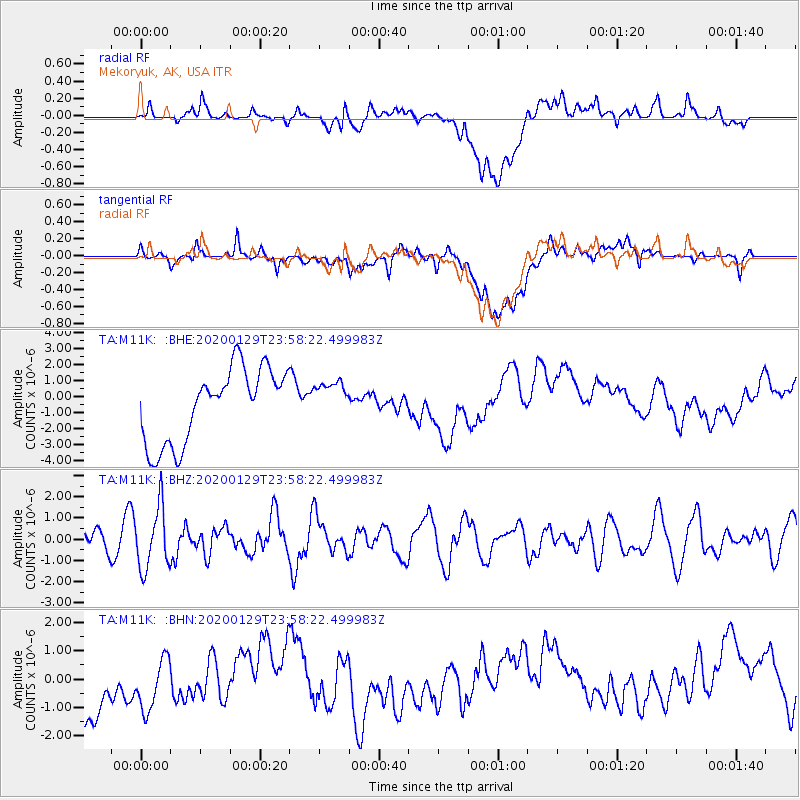
M11K Mekoryuk, AK, USA - Earthquake Result Viewer
*The percent match for this event was below the threshold and hence no stack was calculated.
| Earthquake location: |
Northern Molucca Sea |
| Earthquake latitude/longitude: |
0.7/126.3 |
| Earthquake time(UTC): |
2020/01/29 (029) 23:46:54 GMT |
| Earthquake Depth: |
15 km |
| Earthquake Magnitude: |
5.7 mww |
| Earthquake Catalog/Contributor: |
NEIC PDE/us |
|
| Network: |
TA USArray Transportable Network (new EarthScope stations) |
| Station: |
M11K Mekoryuk, AK, USA |
| Lat/Lon: |
60.38 N/166.20 W |
| Elevation: |
3.0 m |
|
| Distance: |
78.4 deg |
| Az: |
27.931 deg |
| Baz: |
250.559 deg |
| Ray Param: |
$rayparam |
*The percent match for this event was below the threshold and hence was not used in the summary stack. |
|
| Radial Match: |
25.568121 % |
| Radial Bump: |
400 |
| Transverse Match: |
21.733036 % |
| Transverse Bump: |
400 |
| SOD ConfigId: |
20465011 |
| Insert Time: |
2020-02-17 01:35:20.169 +0000 |
| GWidth: |
2.5 |
| Max Bumps: |
400 |
| Tol: |
0.001 |
|
Signal To Noise
| Channel | StoN | STA | LTA |
| TA:M11K: :BHZ:20200129T23:58:22.499983Z | 1.9220135 | 1.4600613E-6 | 7.59652E-7 |
| TA:M11K: :BHN:20200129T23:58:22.499983Z | 0.85217625 | 1.0448634E-6 | 1.2261119E-6 |
| TA:M11K: :BHE:20200129T23:58:22.499983Z | 0.51136833 | 1.1779889E-6 | 2.3036014E-6 |
| Arrivals |
| Ps | |
| PpPs | |
| PsPs/PpSs | |


