You are here: Home > Network List > CI - Caltech Regional Seismic Network Stations List
> Station DAN Danby, California, USA > Earthquake Result Viewer
DAN Danby, California, USA - Earthquake Result Viewer
*The percent match for this event was below the threshold and hence no stack was calculated.
| Earthquake location: |
South Of Fiji Islands |
| Earthquake latitude/longitude: |
-25.4/178.5 |
| Earthquake time(UTC): |
2020/01/31 (031) 13:53:30 GMT |
| Earthquake Depth: |
576 km |
| Earthquake Magnitude: |
5.7 mww |
| Earthquake Catalog/Contributor: |
NEIC PDE/us |
|
| Network: |
CI Caltech Regional Seismic Network |
| Station: |
DAN Danby, California, USA |
| Lat/Lon: |
34.64 N/115.38 W |
| Elevation: |
398 m |
|
| Distance: |
86.5 deg |
| Az: |
49.06 deg |
| Baz: |
235.983 deg |
| Ray Param: |
$rayparam |
*The percent match for this event was below the threshold and hence was not used in the summary stack. |
|
| Radial Match: |
86.77872 % |
| Radial Bump: |
400 |
| Transverse Match: |
49.97329 % |
| Transverse Bump: |
400 |
| SOD ConfigId: |
20465011 |
| Insert Time: |
2020-02-19 06:58:38.868 +0000 |
| GWidth: |
2.5 |
| Max Bumps: |
400 |
| Tol: |
0.001 |
|
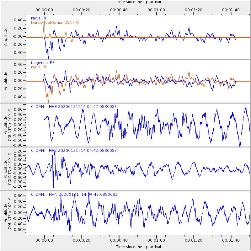
Signal To Noise
| Channel | StoN | STA | LTA |
| CI:DAN: :HHZ:20200131T14:04:42.088008Z | 2.3663244 | 4.375674E-7 | 1.8491437E-7 |
| CI:DAN: :HHN:20200131T14:04:42.088008Z | 0.521904 | 1.1058031E-7 | 2.1187864E-7 |
| CI:DAN: :HHE:20200131T14:04:42.088008Z | 0.6532574 | 2.0627657E-7 | 3.1576613E-7 |
| Arrivals |
| Ps | |
| PpPs | |
| PsPs/PpSs | |


