You are here: Home > Network List > CI - Caltech Regional Seismic Network Stations List
> Station MPP McPhearson Peak > Earthquake Result Viewer
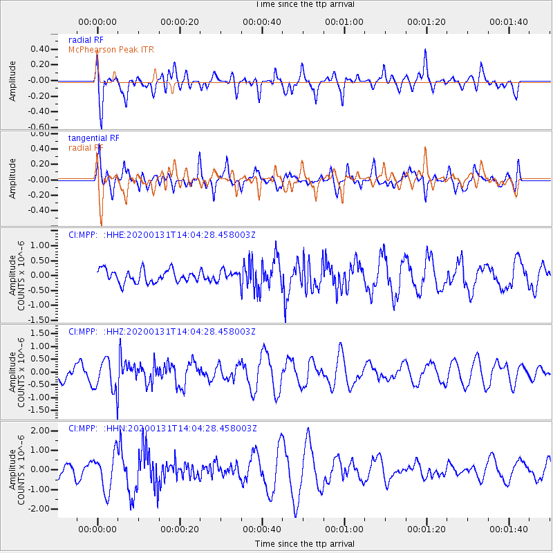
MPP McPhearson Peak - Earthquake Result Viewer
*The percent match for this event was below the threshold and hence no stack was calculated.
| Earthquake location: |
South Of Fiji Islands |
| Earthquake latitude/longitude: |
-25.4/178.5 |
| Earthquake time(UTC): |
2020/01/31 (031) 13:53:30 GMT |
| Earthquake Depth: |
576 km |
| Earthquake Magnitude: |
5.7 mww |
| Earthquake Catalog/Contributor: |
NEIC PDE/us |
|
| Network: |
CI Caltech Regional Seismic Network |
| Station: |
MPP McPhearson Peak |
| Lat/Lon: |
34.89 N/119.81 W |
| Elevation: |
1739 m |
|
| Distance: |
83.7 deg |
| Az: |
46.734 deg |
| Baz: |
233.266 deg |
| Ray Param: |
$rayparam |
*The percent match for this event was below the threshold and hence was not used in the summary stack. |
|
| Radial Match: |
78.79567 % |
| Radial Bump: |
400 |
| Transverse Match: |
61.02073 % |
| Transverse Bump: |
400 |
| SOD ConfigId: |
20465011 |
| Insert Time: |
2020-02-19 07:07:13.729 +0000 |
| GWidth: |
2.5 |
| Max Bumps: |
400 |
| Tol: |
0.001 |
|
Signal To Noise
| Channel | StoN | STA | LTA |
| CI:MPP: :HHZ:20200131T14:04:28.458003Z | 1.7995902 | 6.337323E-7 | 3.5215368E-7 |
| CI:MPP: :HHN:20200131T14:04:28.458003Z | 2.3109498 | 9.860458E-7 | 4.2668427E-7 |
| CI:MPP: :HHE:20200131T14:04:28.458003Z | 0.77943325 | 1.6444001E-7 | 2.1097382E-7 |
| Arrivals |
| Ps | |
| PpPs | |
| PsPs/PpSs | |


