You are here: Home > Network List > TA - USArray Transportable Network (new EarthScope stations) Stations List
> Station K15K Wolf Creek Mountain, AK, USA > Earthquake Result Viewer
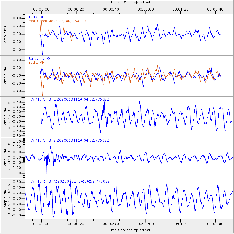
K15K Wolf Creek Mountain, AK, USA - Earthquake Result Viewer
*The percent match for this event was below the threshold and hence no stack was calculated.
| Earthquake location: |
South Of Fiji Islands |
| Earthquake latitude/longitude: |
-25.4/178.5 |
| Earthquake time(UTC): |
2020/01/31 (031) 13:53:30 GMT |
| Earthquake Depth: |
576 km |
| Earthquake Magnitude: |
5.7 mww |
| Earthquake Catalog/Contributor: |
NEIC PDE/us |
|
| Network: |
TA USArray Transportable Network (new EarthScope stations) |
| Station: |
K15K Wolf Creek Mountain, AK, USA |
| Lat/Lon: |
62.29 N/161.53 W |
| Elevation: |
346 m |
|
| Distance: |
88.8 deg |
| Az: |
9.189 deg |
| Baz: |
198.007 deg |
| Ray Param: |
$rayparam |
*The percent match for this event was below the threshold and hence was not used in the summary stack. |
|
| Radial Match: |
57.217346 % |
| Radial Bump: |
400 |
| Transverse Match: |
64.53703 % |
| Transverse Bump: |
400 |
| SOD ConfigId: |
20465011 |
| Insert Time: |
2020-02-19 08:10:49.585 +0000 |
| GWidth: |
2.5 |
| Max Bumps: |
400 |
| Tol: |
0.001 |
|
Signal To Noise
| Channel | StoN | STA | LTA |
| TA:K15K: :BHZ:20200131T14:04:52.77502Z | 1.7093793 | 5.0244466E-7 | 2.93934E-7 |
| TA:K15K: :BHN:20200131T14:04:52.77502Z | 1.101618 | 3.2598655E-7 | 2.9591612E-7 |
| TA:K15K: :BHE:20200131T14:04:52.77502Z | 1.2051024 | 2.745847E-7 | 2.2785174E-7 |
| Arrivals |
| Ps | |
| PpPs | |
| PsPs/PpSs | |


