You are here: Home > Network List > TA - USArray Transportable Network (new EarthScope stations) Stations List
> Station A21K Barrow, AK, USA > Earthquake Result Viewer
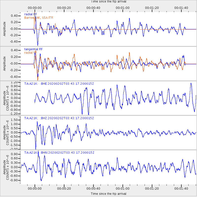
A21K Barrow, AK, USA - Earthquake Result Viewer
*The percent match for this event was below the threshold and hence no stack was calculated.
| Earthquake location: |
Off Coast Of Chiapas, Mexico |
| Earthquake latitude/longitude: |
13.8/-92.8 |
| Earthquake time(UTC): |
2020/02/02 (033) 03:32:44 GMT |
| Earthquake Depth: |
10 km |
| Earthquake Magnitude: |
5.6 Mww |
| Earthquake Catalog/Contributor: |
NEIC PDE/us |
|
| Network: |
TA USArray Transportable Network (new EarthScope stations) |
| Station: |
A21K Barrow, AK, USA |
| Lat/Lon: |
71.32 N/156.62 W |
| Elevation: |
577 m |
|
| Distance: |
68.7 deg |
| Az: |
341.931 deg |
| Baz: |
110.729 deg |
| Ray Param: |
$rayparam |
*The percent match for this event was below the threshold and hence was not used in the summary stack. |
|
| Radial Match: |
53.87209 % |
| Radial Bump: |
400 |
| Transverse Match: |
64.272575 % |
| Transverse Bump: |
390 |
| SOD ConfigId: |
20465011 |
| Insert Time: |
2020-02-20 13:30:58.341 +0000 |
| GWidth: |
2.5 |
| Max Bumps: |
400 |
| Tol: |
0.001 |
|
Signal To Noise
| Channel | StoN | STA | LTA |
| TA:A21K: :BHZ:20200202T03:43:17.200015Z | 6.2015095 | 8.526298E-7 | 1.3748746E-7 |
| TA:A21K: :BHN:20200202T03:43:17.200015Z | 2.1637068 | 5.671269E-7 | 2.6210895E-7 |
| TA:A21K: :BHE:20200202T03:43:17.200015Z | 2.0006783 | 4.8146126E-7 | 2.40649E-7 |
| Arrivals |
| Ps | |
| PpPs | |
| PsPs/PpSs | |


