You are here: Home > Network List > TA - USArray Transportable Network (new EarthScope stations) Stations List
> Station G31M Satah River, YT, CAN > Earthquake Result Viewer
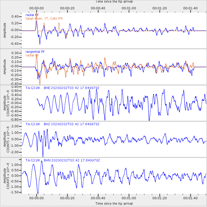
G31M Satah River, YT, CAN - Earthquake Result Viewer
*The percent match for this event was below the threshold and hence no stack was calculated.
| Earthquake location: |
Off Coast Of Chiapas, Mexico |
| Earthquake latitude/longitude: |
13.8/-92.8 |
| Earthquake time(UTC): |
2020/02/02 (033) 03:32:44 GMT |
| Earthquake Depth: |
10 km |
| Earthquake Magnitude: |
5.6 Mww |
| Earthquake Catalog/Contributor: |
NEIC PDE/us |
|
| Network: |
TA USArray Transportable Network (new EarthScope stations) |
| Station: |
G31M Satah River, YT, CAN |
| Lat/Lon: |
66.92 N/134.27 W |
| Elevation: |
61 m |
|
| Distance: |
59.7 deg |
| Az: |
342.406 deg |
| Baz: |
131.847 deg |
| Ray Param: |
$rayparam |
*The percent match for this event was below the threshold and hence was not used in the summary stack. |
|
| Radial Match: |
63.481834 % |
| Radial Bump: |
335 |
| Transverse Match: |
75.09279 % |
| Transverse Bump: |
400 |
| SOD ConfigId: |
20465011 |
| Insert Time: |
2020-02-20 13:36:36.777 +0000 |
| GWidth: |
2.5 |
| Max Bumps: |
400 |
| Tol: |
0.001 |
|
Signal To Noise
| Channel | StoN | STA | LTA |
| TA:G31M: :BHZ:20200202T03:42:17.849979Z | 2.3019483 | 1.009166E-6 | 4.3839648E-7 |
| TA:G31M: :BHN:20200202T03:42:17.849979Z | 2.1719613 | 8.8775596E-7 | 4.0873468E-7 |
| TA:G31M: :BHE:20200202T03:42:17.849979Z | 1.0862544 | 3.04311E-7 | 2.8014708E-7 |
| Arrivals |
| Ps | |
| PpPs | |
| PsPs/PpSs | |


