
PFO Pinon Flat, California, USA - Earthquake Result Viewer
| ||||||||||||||||||
| ||||||||||||||||||
| ||||||||||||||||||
|
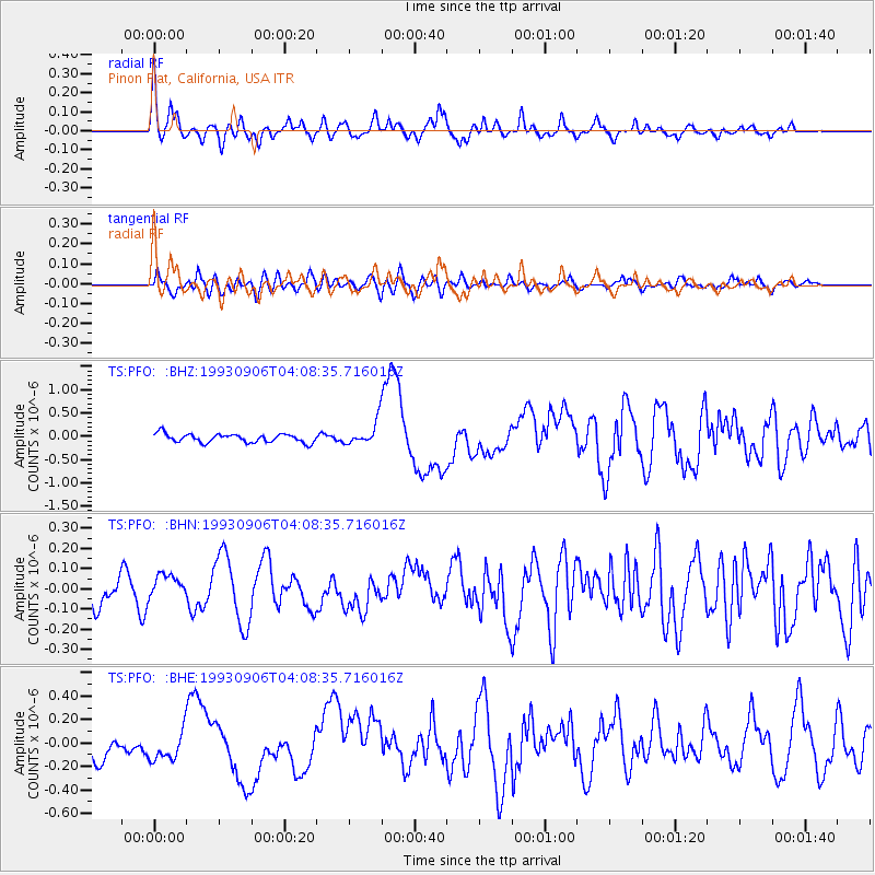
Signal To Noise
| Channel | StoN | STA | LTA |
| TS:PFO: :BHN:19930906T04:08:35.716016Z | 1.126626 | 6.248589E-8 | 5.5462845E-8 |
| TS:PFO: :BHE:19930906T04:08:35.716016Z | 1.6024581 | 1.2604966E-7 | 7.866019E-8 |
| TS:PFO: :BHZ:19930906T04:08:35.716016Z | 2.7521784 | 2.5311488E-7 | 9.196892E-8 |
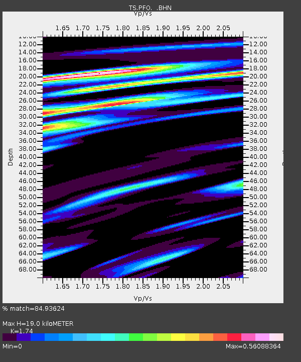
| Arrivals | |
| Ps | 2.3 SECOND |
| PpPs | 8.1 SECOND |
| PsPs/PpSs | 10 SECOND |

