You are here: Home > Network List > CI - Caltech Regional Seismic Network Stations List
> Station TIN Tinemaha, Big Pine, CA, USA > Earthquake Result Viewer
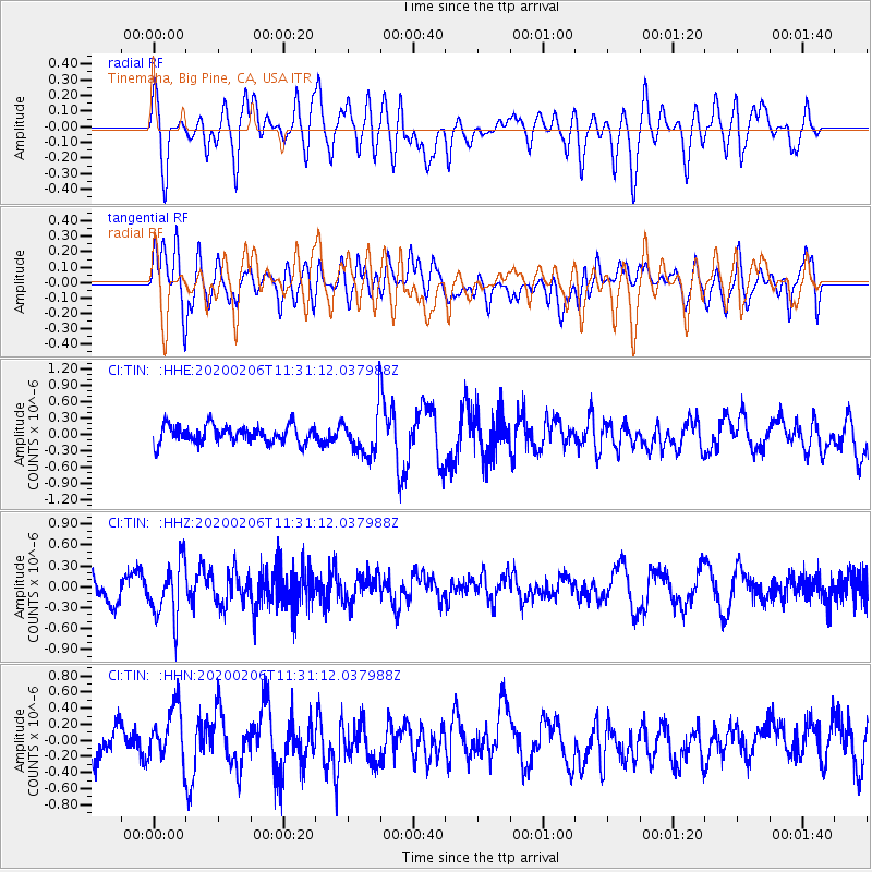
TIN Tinemaha, Big Pine, CA, USA - Earthquake Result Viewer
*The percent match for this event was below the threshold and hence no stack was calculated.
| Earthquake location: |
Near East Coast Of Honshu, Japan |
| Earthquake latitude/longitude: |
36.4/141.8 |
| Earthquake time(UTC): |
2020/02/06 (037) 11:19:56 GMT |
| Earthquake Depth: |
10 km |
| Earthquake Magnitude: |
5.3 Mww |
| Earthquake Catalog/Contributor: |
NEIC PDE/us |
|
| Network: |
CI Caltech Regional Seismic Network |
| Station: |
TIN Tinemaha, Big Pine, CA, USA |
| Lat/Lon: |
37.05 N/118.23 W |
| Elevation: |
1197 m |
|
| Distance: |
75.9 deg |
| Az: |
54.326 deg |
| Baz: |
304.956 deg |
| Ray Param: |
$rayparam |
*The percent match for this event was below the threshold and hence was not used in the summary stack. |
|
| Radial Match: |
40.874714 % |
| Radial Bump: |
400 |
| Transverse Match: |
59.868595 % |
| Transverse Bump: |
400 |
| SOD ConfigId: |
20465011 |
| Insert Time: |
2020-02-23 07:57:46.487 +0000 |
| GWidth: |
2.5 |
| Max Bumps: |
400 |
| Tol: |
0.001 |
|
Signal To Noise
| Channel | StoN | STA | LTA |
| CI:TIN: :HHZ:20200206T11:31:12.037988Z | 2.098267 | 4.0079695E-7 | 1.9101331E-7 |
| CI:TIN: :HHN:20200206T11:31:12.037988Z | 1.4242413 | 3.500153E-7 | 2.4575561E-7 |
| CI:TIN: :HHE:20200206T11:31:12.037988Z | 2.3363793 | 3.7126287E-7 | 1.5890522E-7 |
| Arrivals |
| Ps | |
| PpPs | |
| PsPs/PpSs | |


