VTS Vitosha, Bulgary - Earthquake Result Viewer
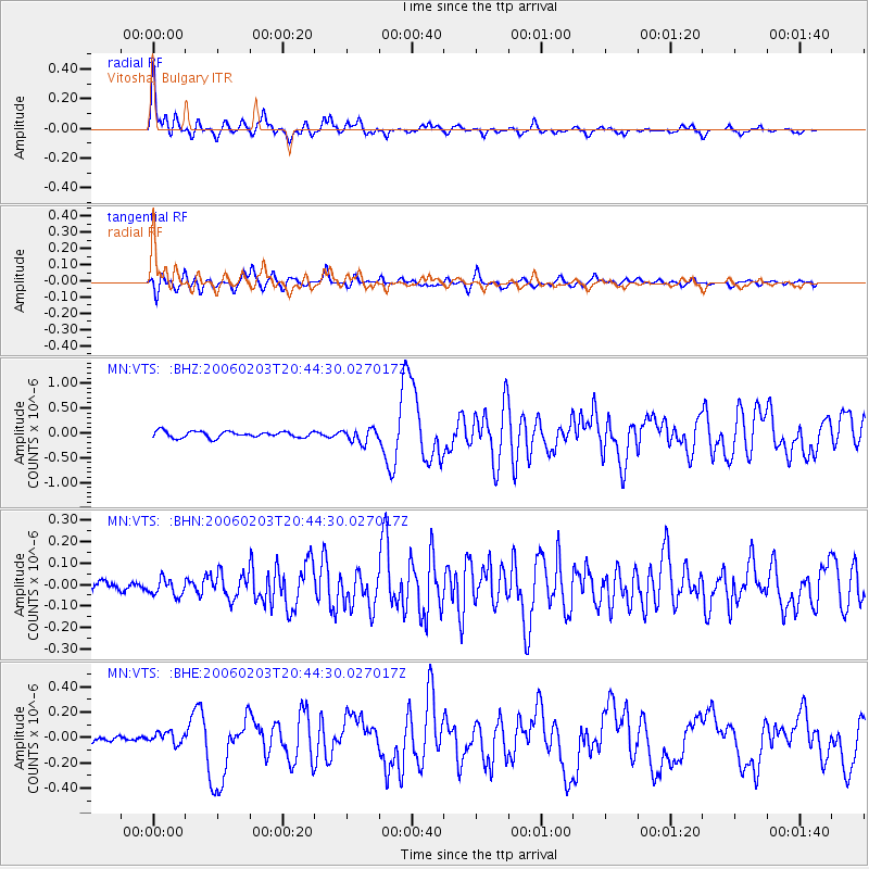
Earthquake location: Andaman Islands, India Region
Earthquake latitude/longitude: 11.9/92.4
Earthquake time(UTC): 2006/02/03 (034) 20:34:12 GMT
Earthquake Depth: 30 km
Earthquake Magnitude: 5.6 MB, 5.9 MS, 6.1 MW, 6.0 MW
Earthquake Catalog/Contributor: WHDF/NEIC
Network: MN MEDNET Project
Station: VTS Vitosha, Bulgary
Lat/Lon: 42.62 N/23.24 E
Elevation: 1490 m
Distance: 66.7 deg
Az: 311.32 deg
Baz: 95.213 deg
Ray Param: 0.05737775
Estimated Moho Depth: 68.75 km
Estimated Crust Vp/Vs: 1.61
Assumed Crust Vp: 6.291 km/s
Estimated Crust Vs: 3.908 km/s
Estimated Crust Poisson's Ratio: 0.19
Radial Match: 95.09005 %
Radial Bump: 400
Transverse Match: 84.01231 %
Transverse Bump: 400
SOD ConfigId: 4977
Insert Time: 2010-03-08 17:51:51.167 +0000
GWidth: 2.5
Max Bumps: 400
Tol: 0.001

Signal To Noise

ChannelStoNSTALTA
MN:VTS: :BHN:20060203T20:44:30.027017Z2.034133.81973E-81.87782E-8
MN:VTS: :BHE:20060203T20:44:30.027017Z1.38245675.189275E-83.7536623E-8
MN:VTS: :BHZ:20060203T20:44:30.027017Z2.20529081.3811726E-76.262995E-8
Arrivals
Ps7.0 SECOND
PpPs27 SECOND
PsPs/PpSs34 SECOND