You are here: Home > Network List > NE - New England Seismic Network Stations List
> Station EMMW Machias, ME, USA > Earthquake Result Viewer
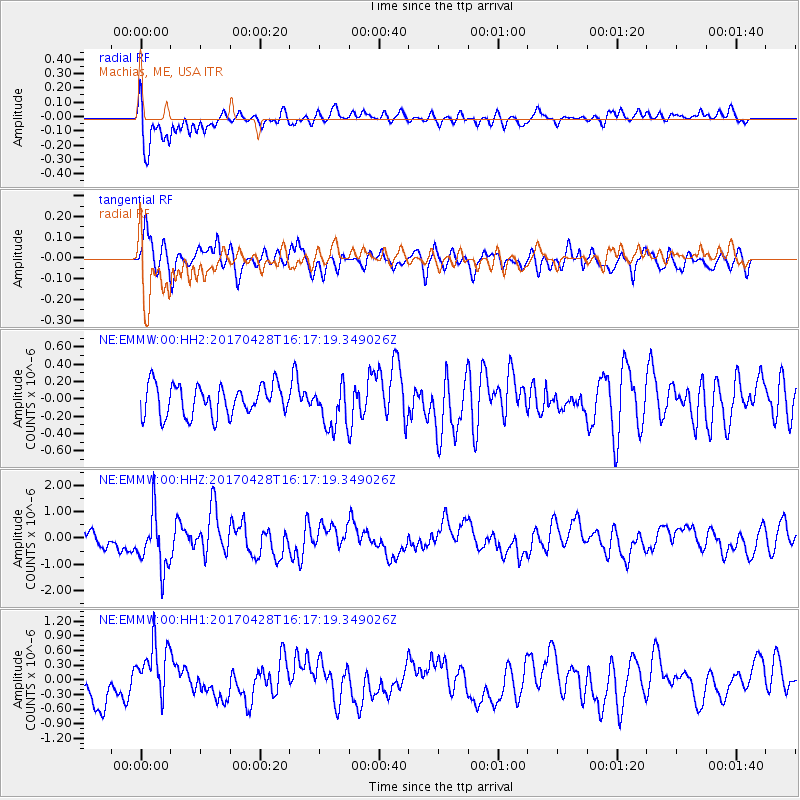
EMMW Machias, ME, USA - Earthquake Result Viewer
*The percent match for this event was below the threshold and hence no stack was calculated.
| Earthquake location: |
Near Coast Of Central Chile |
| Earthquake latitude/longitude: |
-33.1/-71.8 |
| Earthquake time(UTC): |
2017/04/28 (118) 16:05:55 GMT |
| Earthquake Depth: |
14 km |
| Earthquake Magnitude: |
5.7 Mww |
| Earthquake Catalog/Contributor: |
NEIC PDE/us |
|
| Network: |
NE New England Seismic Network |
| Station: |
EMMW Machias, ME, USA |
| Lat/Lon: |
44.71 N/67.46 W |
| Elevation: |
35 m |
|
| Distance: |
77.6 deg |
| Az: |
3.187 deg |
| Baz: |
183.752 deg |
| Ray Param: |
$rayparam |
*The percent match for this event was below the threshold and hence was not used in the summary stack. |
|
| Radial Match: |
79.819046 % |
| Radial Bump: |
400 |
| Transverse Match: |
63.42876 % |
| Transverse Bump: |
400 |
| SOD ConfigId: |
2028011 |
| Insert Time: |
2017-05-12 16:18:30.776 +0000 |
| GWidth: |
2.5 |
| Max Bumps: |
400 |
| Tol: |
0.001 |
|
Signal To Noise
| Channel | StoN | STA | LTA |
| NE:EMMW:00:HHZ:20170428T16:17:19.349026Z | 2.6300292 | 1.0524258E-6 | 4.0015746E-7 |
| NE:EMMW:00:HH1:20170428T16:17:19.349026Z | 1.5896425 | 5.9316267E-7 | 3.7314217E-7 |
| NE:EMMW:00:HH2:20170428T16:17:19.349026Z | 1.4360679 | 2.533468E-7 | 1.76417E-7 |
| Arrivals |
| Ps | |
| PpPs | |
| PsPs/PpSs | |


