VTS Vitosha, Bulgary - Earthquake Result Viewer
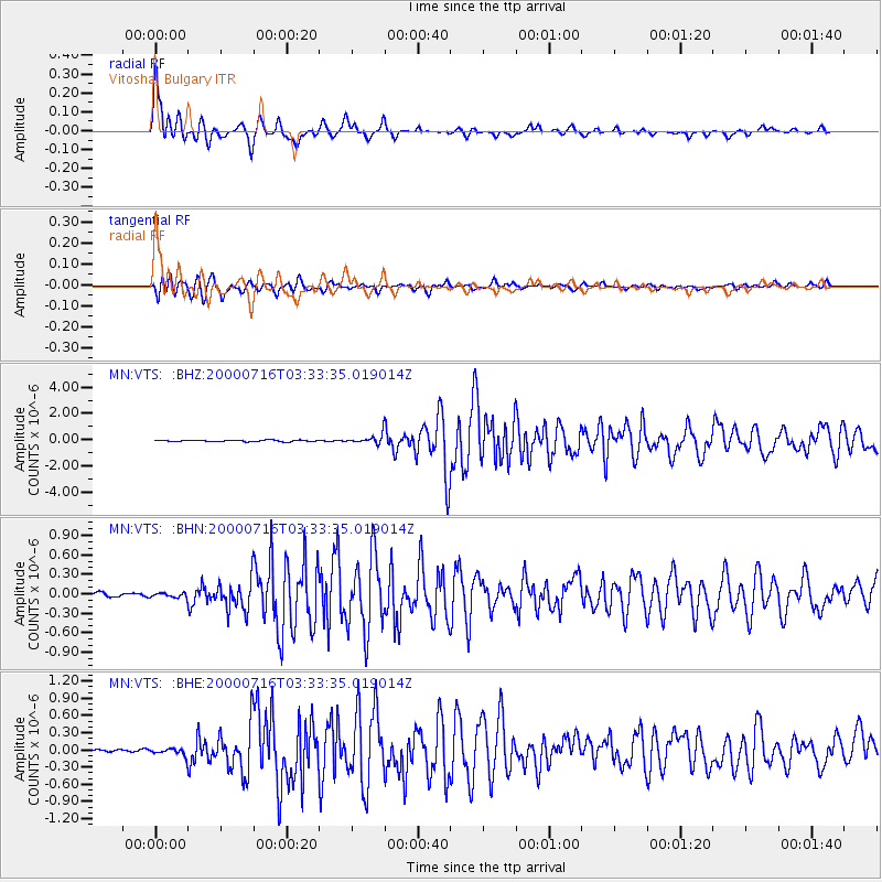
Earthquake location: Philippine Islands Region
Earthquake latitude/longitude: 20.3/122.0
Earthquake time(UTC): 2000/07/16 (198) 03:21:45 GMT
Earthquake Depth: 33 km
Earthquake Magnitude: 6.1 MB, 6.3 MS, 6.4 MW, 6.4 MW
Earthquake Catalog/Contributor: WHDF/NEIC
Network: MN MEDNET Project
Station: VTS Vitosha, Bulgary
Lat/Lon: 42.62 N/23.24 E
Elevation: 1490 m
Distance: 82.8 deg
Az: 312.667 deg
Baz: 69.278 deg
Ray Param: 0.046620306
Estimated Moho Depth: 61.25 km
Estimated Crust Vp/Vs: 1.70
Assumed Crust Vp: 6.291 km/s
Estimated Crust Vs: 3.701 km/s
Estimated Crust Poisson's Ratio: 0.24
Radial Match: 96.98658 %
Radial Bump: 400
Transverse Match: 95.90626 %
Transverse Bump: 400
SOD ConfigId: 3744
Insert Time: 2010-03-08 17:52:10.808 +0000
GWidth: 2.5
Max Bumps: 400
Tol: 0.001

Signal To Noise

ChannelStoNSTALTA
MN:VTS: :BHN:20000716T03:33:35.019014Z1.12141183.605462E-83.2151096E-8
MN:VTS: :BHE:20000716T03:33:35.019014Z2.2276316.903351E-83.098965E-8
MN:VTS: :BHZ:20000716T03:33:35.019014Z6.2056573.3352575E-75.374544E-8
Arrivals
Ps7.0 SECOND
PpPs26 SECOND
PsPs/PpSs33 SECOND