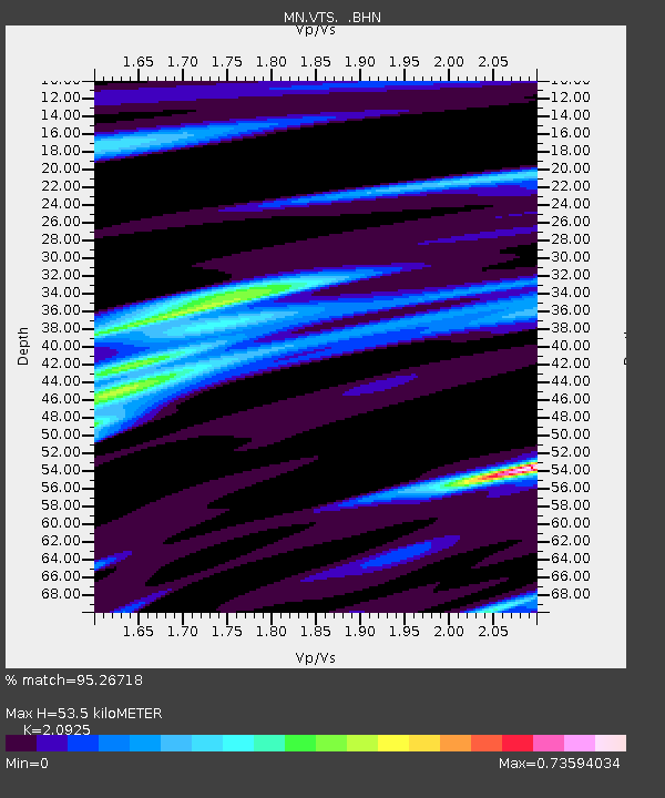
VTS Vitosha, Bulgary - Earthquake Result Viewer

Earthquake location: Northern Mid-Atlantic Ridge
Earthquake latitude/longitude: 31.7/-41.0
Earthquake time(UTC): 2000/10/05 (279) 13:39:11 GMT
Earthquake Depth: 10 km
Earthquake Magnitude: 5.4 MB, 6.1 MS, 6.0 MW, 5.9 MW
Earthquake Catalog/Contributor: WHDF/NEIC
Network: MN MEDNET Project
Station: VTS Vitosha, Bulgary
Lat/Lon: 42.62 N/23.24 E
Elevation: 1490 m
Distance: 51.2 deg
Az: 58.535 deg
Baz: 280.059 deg
Ray Param: 0.06757746
Estimated Moho Depth: 53.5 km
Estimated Crust Vp/Vs: 2.09
Assumed Crust Vp: 6.291 km/s
Estimated Crust Vs: 3.007 km/s
Estimated Crust Poisson's Ratio: 0.35
Radial Match: 95.26718 %
Radial Bump: 298
Transverse Match: 74.7527 %
Transverse Bump: 400
SOD ConfigId: 3744
Insert Time: 2010-03-08 17:52:26.864 +0000
GWidth: 2.5
Max Bumps: 400
Tol: 0.001

Signal To Noise

ChannelStoNSTALTA
MN:VTS: :BHN:20001005T13:47:43.94301Z1.02815124.5770555E-84.451734E-8
MN:VTS: :BHE:20001005T13:47:43.94301Z1.70105627.708302E-84.53148E-8
MN:VTS: :BHZ:20001005T13:47:43.94301Z1.44972489.6825374E-86.67888E-8
Arrivals
Ps9.7 SECOND
PpPs25 SECOND
PsPs/PpSs35 SECOND