VTS Vitosha, Bulgary - Earthquake Result Viewer
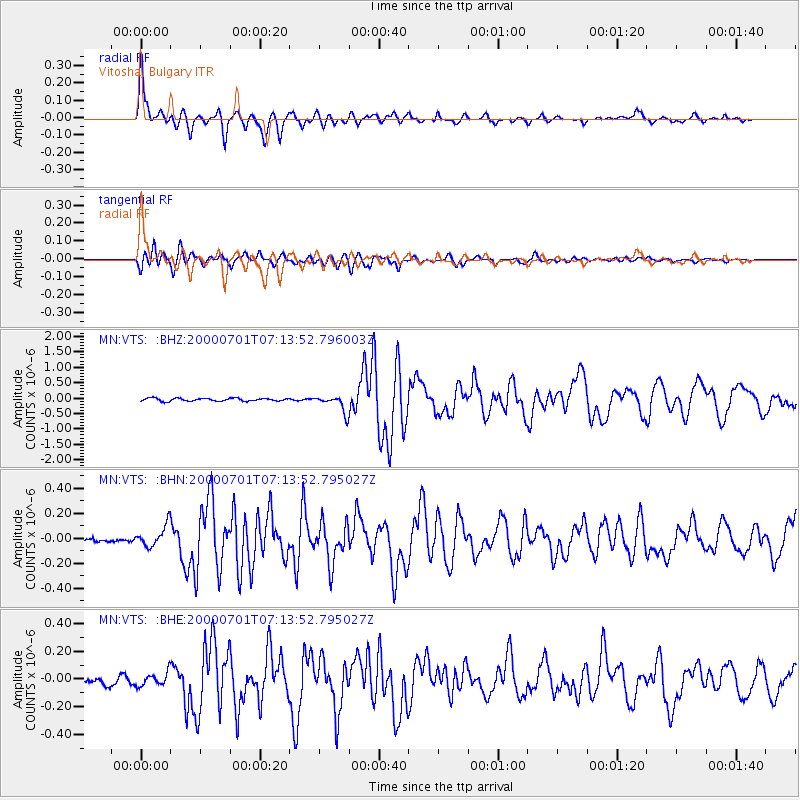
Earthquake location: Near S. Coast Of Honshu, Japan
Earthquake latitude/longitude: 34.2/139.1
Earthquake time(UTC): 2000/07/01 (183) 07:01:55 GMT
Earthquake Depth: 10 km
Earthquake Magnitude: 6.0 MB, 6.1 MS, 6.2 MW, 6.2 MW
Earthquake Catalog/Contributor: WHDF/NEIC
Network: MN MEDNET Project
Station: VTS Vitosha, Bulgary
Lat/Lon: 42.62 N/23.24 E
Elevation: 1490 m
Distance: 83.7 deg
Az: 318.078 deg
Baz: 48.592 deg
Ray Param: 0.04603462
Estimated Moho Depth: 36.25 km
Estimated Crust Vp/Vs: 1.85
Assumed Crust Vp: 6.291 km/s
Estimated Crust Vs: 3.401 km/s
Estimated Crust Poisson's Ratio: 0.29
Radial Match: 94.82776 %
Radial Bump: 350
Transverse Match: 88.969765 %
Transverse Bump: 400
SOD ConfigId: 3744
Insert Time: 2010-03-08 17:52:40.273 +0000
GWidth: 2.5
Max Bumps: 400
Tol: 0.001

Signal To Noise

ChannelStoNSTALTA
MN:VTS: :BHN:20000701T07:13:52.795027Z3.26910048.381688E-82.5639125E-8
MN:VTS: :BHE:20000701T07:13:52.795027Z1.55823785.0631343E-83.2492693E-8
MN:VTS: :BHZ:20000701T07:13:52.796003Z6.19380572.7518783E-74.4429523E-8
Arrivals
Ps5.0 SECOND
PpPs16 SECOND
PsPs/PpSs21 SECOND