
VTS Vitosha, Bulgary - Earthquake Result Viewer

| ||||||||||||||||||
| ||||||||||||||||||
| ||||||||||||||||||
|
Signal To Noise
| Channel | StoN | STA | LTA |
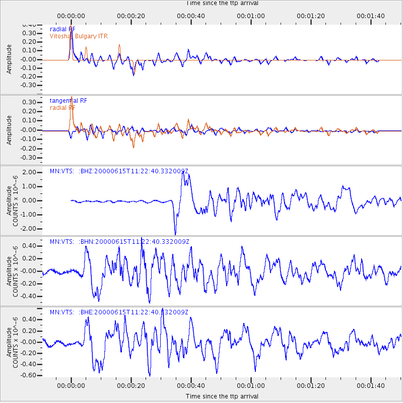
| MN:VTS: :BHN:20000615T11:22:40.332009Z | 2.8562577 | 1.0547392E-7 | 3.6927315E-8 |
| MN:VTS: :BHE:20000615T11:22:40.332009Z | 1.9246857 | 1.0242977E-7 | 5.321896E-8 |
| MN:VTS: :BHZ:20000615T11:22:40.332009Z | 14.956809 | 6.1737984E-7 | 4.127751E-8 |
| Arrivals | |
| Ps | 4.9 SECOND |
| PpPs | 16 SECOND |
| PsPs/PpSs | 21 SECOND |

