You are here: Home > Network List > TA - USArray Transportable Network (new EarthScope stations) Stations List
> Station F21K Alatna River, AK, USA > Earthquake Result Viewer
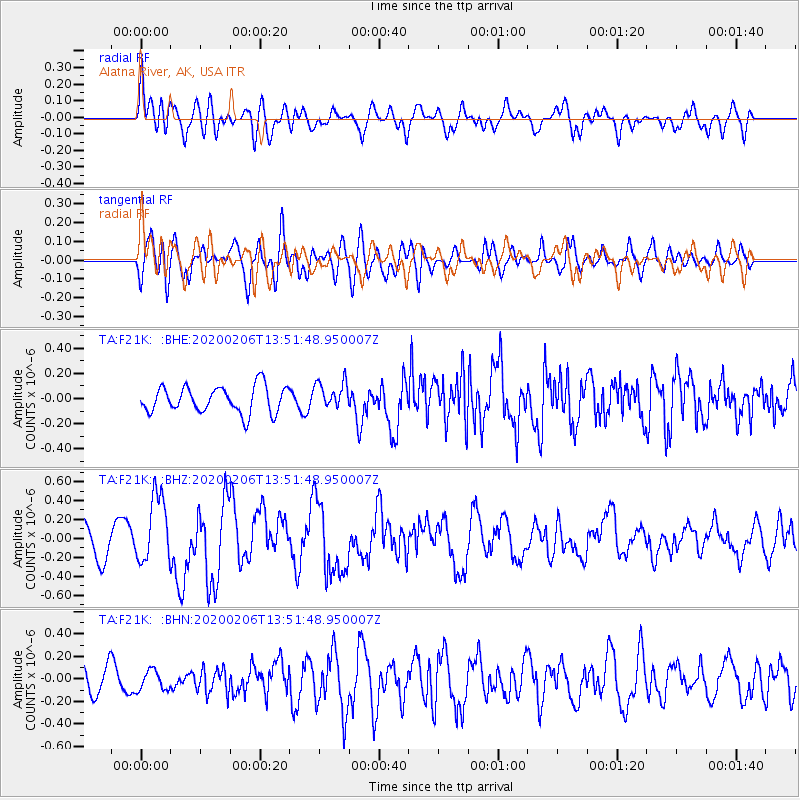
F21K Alatna River, AK, USA - Earthquake Result Viewer
*The percent match for this event was below the threshold and hence no stack was calculated.
| Earthquake location: |
Mindanao, Philippines |
| Earthquake latitude/longitude: |
5.5/126.5 |
| Earthquake time(UTC): |
2020/02/06 (037) 13:40:09 GMT |
| Earthquake Depth: |
44 km |
| Earthquake Magnitude: |
6.0 Mww |
| Earthquake Catalog/Contributor: |
NEIC PDE/us |
|
| Network: |
TA USArray Transportable Network (new EarthScope stations) |
| Station: |
F21K Alatna River, AK, USA |
| Lat/Lon: |
67.22 N/153.48 W |
| Elevation: |
597 m |
|
| Distance: |
81.1 deg |
| Az: |
22.839 deg |
| Baz: |
262.907 deg |
| Ray Param: |
$rayparam |
*The percent match for this event was below the threshold and hence was not used in the summary stack. |
|
| Radial Match: |
58.140285 % |
| Radial Bump: |
400 |
| Transverse Match: |
64.74287 % |
| Transverse Bump: |
400 |
| SOD ConfigId: |
20465011 |
| Insert Time: |
2020-02-24 13:48:26.595 +0000 |
| GWidth: |
2.5 |
| Max Bumps: |
400 |
| Tol: |
0.001 |
|
Signal To Noise
| Channel | StoN | STA | LTA |
| TA:F21K: :BHZ:20200206T13:51:48.950007Z | 2.1034014 | 3.5898307E-7 | 1.7066789E-7 |
| TA:F21K: :BHN:20200206T13:51:48.950007Z | 1.0074455 | 8.810691E-8 | 8.745576E-8 |
| TA:F21K: :BHE:20200206T13:51:48.950007Z | 1.0264888 | 1.0781634E-7 | 1.05034104E-7 |
| Arrivals |
| Ps | |
| PpPs | |
| PsPs/PpSs | |


