VTS Vitosha, Bulgary - Earthquake Result Viewer
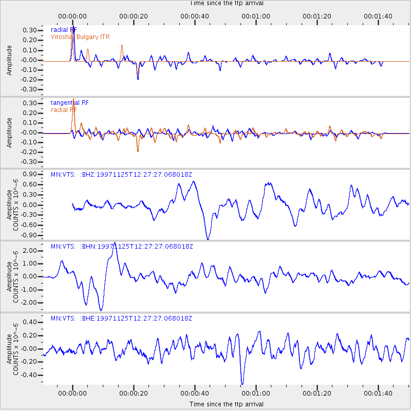
Earthquake location: Minahassa Peninsula, Sulawesi
Earthquake latitude/longitude: 1.2/122.5
Earthquake time(UTC): 1997/11/25 (329) 12:14:33 GMT
Earthquake Depth: 24 km
Earthquake Magnitude: 6.1 MB, 6.8 MS, 7.1 UNKNOWN, 6.7 ME
Earthquake Catalog/Contributor: WHDF/NEIC
Network: MN MEDNET Project
Station: VTS Vitosha, Bulgary
Lat/Lon: 42.62 N/23.24 E
Elevation: 1490 m
Distance: 96.0 deg
Az: 312.906 deg
Baz: 82.786 deg
Ray Param: 0.040621113
Estimated Moho Depth: 59.0 km
Estimated Crust Vp/Vs: 1.83
Assumed Crust Vp: 6.291 km/s
Estimated Crust Vs: 3.433 km/s
Estimated Crust Poisson's Ratio: 0.29
Radial Match: 94.76859 %
Radial Bump: 319
Transverse Match: 82.26317 %
Transverse Bump: 400
SOD ConfigId: 4480
Insert Time: 2010-03-08 17:53:40.426 +0000
GWidth: 2.5
Max Bumps: 400
Tol: 0.001

Signal To Noise

ChannelStoNSTALTA
MN:VTS: :BHN:19971125T12:27:27.068018Z15.9571191.0069535E-66.310371E-8
MN:VTS: :BHE:19971125T12:27:27.068018Z1.01697395.9019094E-85.8034033E-8
MN:VTS: :BHZ:19971125T12:27:27.068018Z3.70129252.5862542E-76.987436E-8
Arrivals
Ps8.0 SECOND
PpPs26 SECOND
PsPs/PpSs34 SECOND