VTS Vitosha, Bulgary - Earthquake Result Viewer
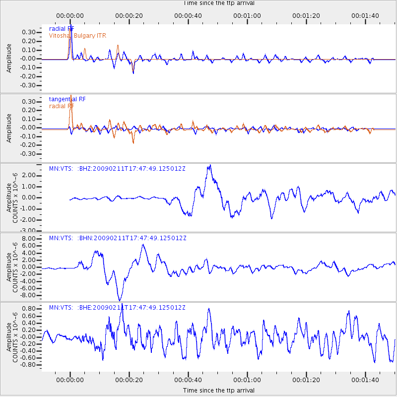
Earthquake location: Talaud Islands, Indonesia
Earthquake latitude/longitude: 3.9/126.4
Earthquake time(UTC): 2009/02/11 (042) 17:34:50 GMT
Earthquake Depth: 22 km
Earthquake Magnitude: 6.6 MB, 7.2 MS, 7.2 MW, 7.1 MW
Earthquake Catalog/Contributor: WHDF/NEIC
Network: MN MEDNET Project
Station: VTS Vitosha, Bulgary
Lat/Lon: 42.62 N/23.24 E
Elevation: 1490 m
Distance: 97.0 deg
Az: 313.598 deg
Baz: 78.201 deg
Ray Param: 0.040330708
Estimated Moho Depth: 31.5 km
Estimated Crust Vp/Vs: 1.77
Assumed Crust Vp: 6.291 km/s
Estimated Crust Vs: 3.554 km/s
Estimated Crust Poisson's Ratio: 0.27
Radial Match: 96.67217 %
Radial Bump: 400
Transverse Match: 86.60417 %
Transverse Bump: 400
SOD ConfigId: 2658
Insert Time: 2010-03-08 17:53:42.933 +0000
GWidth: 2.5
Max Bumps: 400
Tol: 0.001

Signal To Noise

ChannelStoNSTALTA
MN:VTS: :BHN:20090211T17:47:49.125012Z9.3573318.047086E-78.5997655E-8
MN:VTS: :BHE:20090211T17:47:49.125012Z0.722129464.800678E-86.6479465E-8
MN:VTS: :BHZ:20090211T17:47:49.125012Z2.62163022.499948E-79.535853E-8
Arrivals
Ps3.9 SECOND
PpPs14 SECOND
PsPs/PpSs18 SECOND