VTS Vitosha, Bulgary - Earthquake Result Viewer
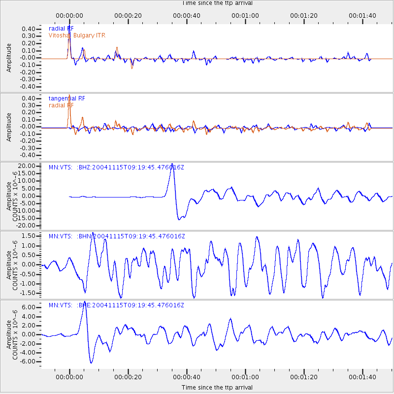
Earthquake location: Near West Coast Of Colombia
Earthquake latitude/longitude: 4.7/-77.5
Earthquake time(UTC): 2004/11/15 (320) 09:06:56 GMT
Earthquake Depth: 15 km
Earthquake Magnitude: 6.6 MB, 7.1 MS, 7.2 MW, 7.1 MW
Earthquake Catalog/Contributor: WHDF/NEIC
Network: MN MEDNET Project
Station: VTS Vitosha, Bulgary
Lat/Lon: 42.62 N/23.24 E
Elevation: 1490 m
Distance: 94.7 deg
Az: 46.692 deg
Baz: 280.719 deg
Ray Param: 0.04097011
Estimated Moho Depth: 40.5 km
Estimated Crust Vp/Vs: 1.71
Assumed Crust Vp: 6.291 km/s
Estimated Crust Vs: 3.69 km/s
Estimated Crust Poisson's Ratio: 0.24
Radial Match: 95.11075 %
Radial Bump: 328
Transverse Match: 84.685104 %
Transverse Bump: 400
SOD ConfigId: 2459
Insert Time: 2010-03-08 17:54:11.578 +0000
GWidth: 2.5
Max Bumps: 400
Tol: 0.001

Signal To Noise

ChannelStoNSTALTA
MN:VTS: :BHN:20041115T09:19:45.476016Z2.60194975.3694487E-72.0636251E-7
MN:VTS: :BHE:20041115T09:19:45.476016Z12.6177292.3166851E-61.8360555E-7
MN:VTS: :BHZ:20041115T09:19:45.476016Z43.6280987.0937253E-61.6259534E-7
Arrivals
Ps4.6 SECOND
PpPs17 SECOND
PsPs/PpSs22 SECOND