You are here: Home > Network List > MN - MEDNET Project Stations List
> Station VTS Vitosha, Bulgary > Earthquake Result Viewer
VTS Vitosha, Bulgary - Earthquake Result Viewer

| Earthquake location: |
Taiwan Region |
| Earthquake latitude/longitude: |
22.7/121.5 |
| Earthquake time(UTC): |
2004/05/19 (140) 07:04:11 GMT |
| Earthquake Depth: |
20 km |
| Earthquake Magnitude: |
5.8 MB, 6.1 MS, 6.2 MW, 6.1 MW |
| Earthquake Catalog/Contributor: |
WHDF/NEIC |
|
| Network: |
MN MEDNET Project |
| Station: |
VTS Vitosha, Bulgary |
| Lat/Lon: |
42.62 N/23.24 E |
| Elevation: |
1490 m |
|
| Distance: |
80.8 deg |
| Az: |
312.264 deg |
| Baz: |
67.834 deg |
| Ray Param: |
0.048032936 |
| Estimated Moho Depth: |
36.0 km |
| Estimated Crust Vp/Vs: |
1.87 |
| Assumed Crust Vp: |
6.291 km/s |
| Estimated Crust Vs: |
3.364 km/s |
| Estimated Crust Poisson's Ratio: |
0.30 |
|
| Radial Match: |
97.13179 % |
| Radial Bump: |
342 |
| Transverse Match: |
90.53428 % |
| Transverse Bump: |
400 |
| SOD ConfigId: |
2459 |
| Insert Time: |
2010-03-08 17:54:40.214 +0000 |
| GWidth: |
2.5 |
| Max Bumps: |
400 |
| Tol: |
0.001 |
|
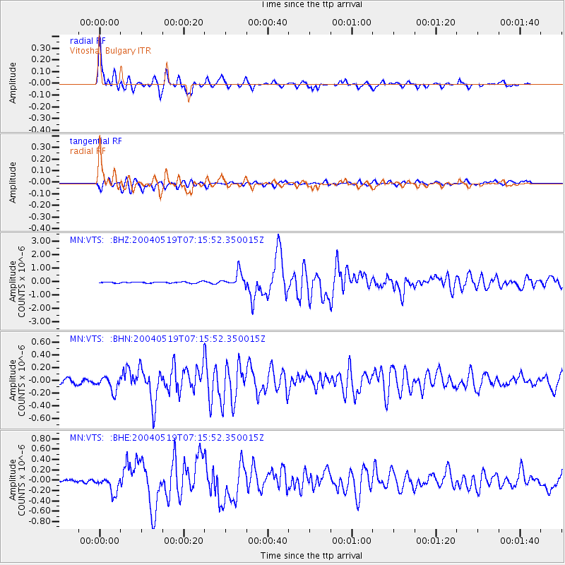
Signal To Noise
| Channel | StoN | STA | LTA |
| MN:VTS: :BHN:20040519T07:15:52.350015Z | 3.6549637 | 1.16873274E-7 | 3.197659E-8 |
| MN:VTS: :BHE:20040519T07:15:52.350015Z | 5.2853117 | 1.6526734E-7 | 3.1269174E-8 |
| MN:VTS: :BHZ:20040519T07:15:52.350015Z | 11.8560705 | 5.404322E-7 | 4.558274E-8 |
| Arrivals |
| Ps | 5.1 SECOND |
| PpPs | 16 SECOND |
| PsPs/PpSs | 21 SECOND |


