You are here: Home > Network List > TA - USArray Transportable Network (new EarthScope stations) Stations List
> Station F20K Avaraart Lake, AK, USA > Earthquake Result Viewer
F20K Avaraart Lake, AK, USA - Earthquake Result Viewer

| Earthquake location: |
New Britain Region, P.N.G. |
| Earthquake latitude/longitude: |
-5.5/152.1 |
| Earthquake time(UTC): |
2020/02/09 (040) 06:04:29 GMT |
| Earthquake Depth: |
31 km |
| Earthquake Magnitude: |
6.2 mww |
| Earthquake Catalog/Contributor: |
NEIC PDE/us |
|
| Network: |
TA USArray Transportable Network (new EarthScope stations) |
| Station: |
F20K Avaraart Lake, AK, USA |
| Lat/Lon: |
67.05 N/155.73 W |
| Elevation: |
136 m |
|
| Distance: |
81.2 deg |
| Az: |
18.267 deg |
| Baz: |
232.722 deg |
| Ray Param: |
0.047703803 |
| Estimated Moho Depth: |
27.75 km |
| Estimated Crust Vp/Vs: |
1.74 |
| Assumed Crust Vp: |
6.522 km/s |
| Estimated Crust Vs: |
3.743 km/s |
| Estimated Crust Poisson's Ratio: |
0.25 |
|
| Radial Match: |
91.82108 % |
| Radial Bump: |
315 |
| Transverse Match: |
75.58617 % |
| Transverse Bump: |
400 |
| SOD ConfigId: |
20792311 |
| Insert Time: |
2020-03-02 02:20:50.808 +0000 |
| GWidth: |
2.5 |
| Max Bumps: |
400 |
| Tol: |
0.001 |
|
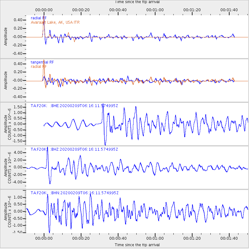
Signal To Noise
| Channel | StoN | STA | LTA |
| TA:F20K: :BHZ:20200209T06:16:11.574995Z | 11.067053 | 2.3551788E-6 | 2.1280994E-7 |
| TA:F20K: :BHN:20200209T06:16:11.574995Z | 3.0544662 | 6.290067E-7 | 2.0593016E-7 |
| TA:F20K: :BHE:20200209T06:16:11.574995Z | 4.5753264 | 9.4751385E-7 | 2.0709207E-7 |
| Arrivals |
| Ps | 3.3 SECOND |
| PpPs | 11 SECOND |
| PsPs/PpSs | 15 SECOND |


