You are here: Home > Network List > TA - USArray Transportable Network (new EarthScope stations) Stations List
> Station O17K Koliganek, Bristol Bay, AK, USA > Earthquake Result Viewer
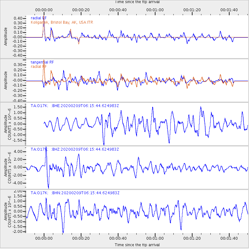
O17K Koliganek, Bristol Bay, AK, USA - Earthquake Result Viewer
*The percent match for this event was below the threshold and hence no stack was calculated.
| Earthquake location: |
New Britain Region, P.N.G. |
| Earthquake latitude/longitude: |
-5.5/152.1 |
| Earthquake time(UTC): |
2020/02/09 (040) 06:04:29 GMT |
| Earthquake Depth: |
31 km |
| Earthquake Magnitude: |
6.2 mww |
| Earthquake Catalog/Contributor: |
NEIC PDE/us |
|
| Network: |
TA USArray Transportable Network (new EarthScope stations) |
| Station: |
O17K Koliganek, Bristol Bay, AK, USA |
| Lat/Lon: |
59.77 N/157.09 W |
| Elevation: |
156 m |
|
| Distance: |
76.3 deg |
| Az: |
23.804 deg |
| Baz: |
232.577 deg |
| Ray Param: |
$rayparam |
*The percent match for this event was below the threshold and hence was not used in the summary stack. |
|
| Radial Match: |
63.958656 % |
| Radial Bump: |
377 |
| Transverse Match: |
68.549484 % |
| Transverse Bump: |
400 |
| SOD ConfigId: |
20792311 |
| Insert Time: |
2020-03-02 02:28:15.742 +0000 |
| GWidth: |
2.5 |
| Max Bumps: |
400 |
| Tol: |
0.001 |
|
Signal To Noise
| Channel | StoN | STA | LTA |
| TA:O17K: :BHZ:20200209T06:15:44.624983Z | 5.590109 | 2.3660969E-6 | 4.232649E-7 |
| TA:O17K: :BHN:20200209T06:15:44.624983Z | 1.413014 | 5.264305E-7 | 3.725586E-7 |
| TA:O17K: :BHE:20200209T06:15:44.624983Z | 2.303235 | 7.69302E-7 | 3.3400934E-7 |
| Arrivals |
| Ps | |
| PpPs | |
| PsPs/PpSs | |


