VTS Vitosha, Bulgary - Earthquake Result Viewer
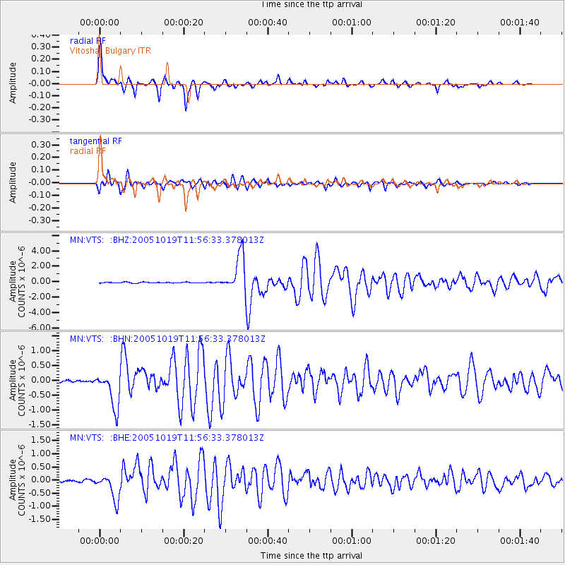
Earthquake location: Near East Coast Of Honshu, Japan
Earthquake latitude/longitude: 36.4/140.8
Earthquake time(UTC): 2005/10/19 (292) 11:44:42 GMT
Earthquake Depth: 32 km
Earthquake Magnitude: 6.2 MB, 6.5 MS, 6.4 MW, 6.3 MW
Earthquake Catalog/Contributor: WHDF/NEIC
Network: MN MEDNET Project
Station: VTS Vitosha, Bulgary
Lat/Lon: 42.62 N/23.24 E
Elevation: 1490 m
Distance: 83.0 deg
Az: 318.768 deg
Baz: 46.084 deg
Ray Param: 0.04648949
Estimated Moho Depth: 35.25 km
Estimated Crust Vp/Vs: 1.87
Assumed Crust Vp: 6.291 km/s
Estimated Crust Vs: 3.36 km/s
Estimated Crust Poisson's Ratio: 0.30
Radial Match: 97.601105 %
Radial Bump: 336
Transverse Match: 92.27353 %
Transverse Bump: 400
SOD ConfigId: 2475
Insert Time: 2010-03-08 17:57:38.567 +0000
GWidth: 2.5
Max Bumps: 400
Tol: 0.001

Signal To Noise

ChannelStoNSTALTA
MN:VTS: :BHN:20051019T11:56:33.378013Z18.2110026.313196E-73.4666932E-8
MN:VTS: :BHE:20051019T11:56:33.378013Z10.4613775.237129E-75.0061562E-8
MN:VTS: :BHZ:20051019T11:56:33.378013Z43.3520552.4937935E-65.752423E-8
Arrivals
Ps5.0 SECOND
PpPs16 SECOND
PsPs/PpSs21 SECOND