You are here: Home > Network List > IU - Global Seismograph Network (GSN - IRIS/USGS) Stations List
> Station POHA Pohakuloa, Hawaii, USA > Earthquake Result Viewer
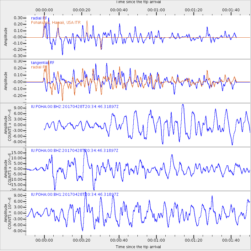
POHA Pohakuloa, Hawaii, USA - Earthquake Result Viewer
*The percent match for this event was below the threshold and hence no stack was calculated.
| Earthquake location: |
Mindanao, Philippines |
| Earthquake latitude/longitude: |
5.5/125.1 |
| Earthquake time(UTC): |
2017/04/28 (118) 20:23:18 GMT |
| Earthquake Depth: |
10 km |
| Earthquake Magnitude: |
7.2 Mi |
| Earthquake Catalog/Contributor: |
NEIC PDE/pt |
|
| Network: |
IU Global Seismograph Network (GSN - IRIS/USGS) |
| Station: |
POHA Pohakuloa, Hawaii, USA |
| Lat/Lon: |
19.76 N/155.53 W |
| Elevation: |
1990 m |
|
| Distance: |
78.2 deg |
| Az: |
71.038 deg |
| Baz: |
271.63 deg |
| Ray Param: |
$rayparam |
*The percent match for this event was below the threshold and hence was not used in the summary stack. |
|
| Radial Match: |
78.51851 % |
| Radial Bump: |
400 |
| Transverse Match: |
77.21336 % |
| Transverse Bump: |
400 |
| SOD ConfigId: |
2028011 |
| Insert Time: |
2017-05-12 20:29:15.998 +0000 |
| GWidth: |
2.5 |
| Max Bumps: |
400 |
| Tol: |
0.001 |
|
Signal To Noise
| Channel | StoN | STA | LTA |
| IU:POHA:00:BHZ:20170428T20:34:46.31897Z | 3.497768 | 5.7720003E-6 | 1.6501954E-6 |
| IU:POHA:00:BH1:20170428T20:34:46.31897Z | 0.6106372 | 1.6829547E-6 | 2.7560632E-6 |
| IU:POHA:00:BH2:20170428T20:34:46.31897Z | 1.6995366 | 2.3931436E-6 | 1.4081154E-6 |
| Arrivals |
| Ps | |
| PpPs | |
| PsPs/PpSs | |


