You are here: Home > Network List > IU - Global Seismograph Network (GSN - IRIS/USGS) Stations List
> Station XMAS Kiritimati Island, Republic of Kiribati > Earthquake Result Viewer
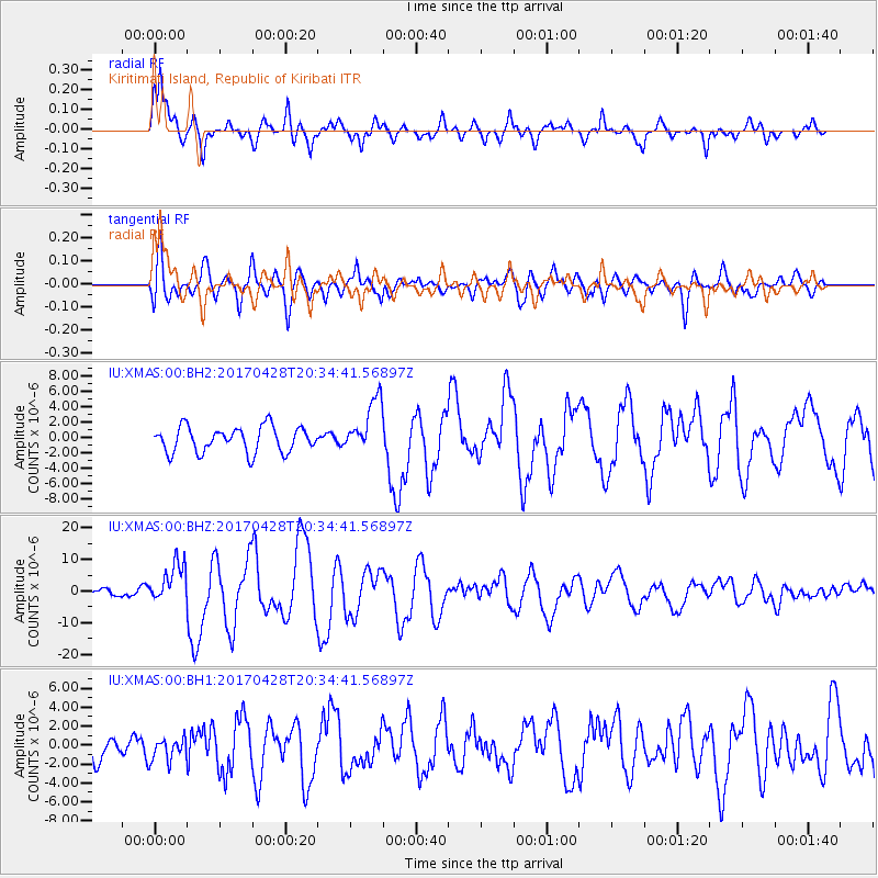
XMAS Kiritimati Island, Republic of Kiribati - Earthquake Result Viewer
*The percent match for this event was below the threshold and hence no stack was calculated.
| Earthquake location: |
Mindanao, Philippines |
| Earthquake latitude/longitude: |
5.5/125.1 |
| Earthquake time(UTC): |
2017/04/28 (118) 20:23:18 GMT |
| Earthquake Depth: |
10 km |
| Earthquake Magnitude: |
7.2 Mi |
| Earthquake Catalog/Contributor: |
NEIC PDE/pt |
|
| Network: |
IU Global Seismograph Network (GSN - IRIS/USGS) |
| Station: |
XMAS Kiritimati Island, Republic of Kiribati |
| Lat/Lon: |
2.04 N/157.45 W |
| Elevation: |
20 m |
|
| Distance: |
77.4 deg |
| Az: |
89.133 deg |
| Baz: |
275.123 deg |
| Ray Param: |
$rayparam |
*The percent match for this event was below the threshold and hence was not used in the summary stack. |
|
| Radial Match: |
87.47554 % |
| Radial Bump: |
400 |
| Transverse Match: |
82.67235 % |
| Transverse Bump: |
400 |
| SOD ConfigId: |
2028011 |
| Insert Time: |
2017-05-12 20:29:29.907 +0000 |
| GWidth: |
2.5 |
| Max Bumps: |
400 |
| Tol: |
0.001 |
|
Signal To Noise
| Channel | StoN | STA | LTA |
| IU:XMAS:00:BHZ:20170428T20:34:41.56897Z | 6.328429 | 6.3319553E-6 | 1.0005572E-6 |
| IU:XMAS:00:BH1:20170428T20:34:41.56897Z | 0.8950994 | 1.2632441E-6 | 1.4112893E-6 |
| IU:XMAS:00:BH2:20170428T20:34:41.56897Z | 2.1424246 | 3.5081168E-6 | 1.6374516E-6 |
| Arrivals |
| Ps | |
| PpPs | |
| PsPs/PpSs | |


