VTS Vitosha, Bulgary - Earthquake Result Viewer
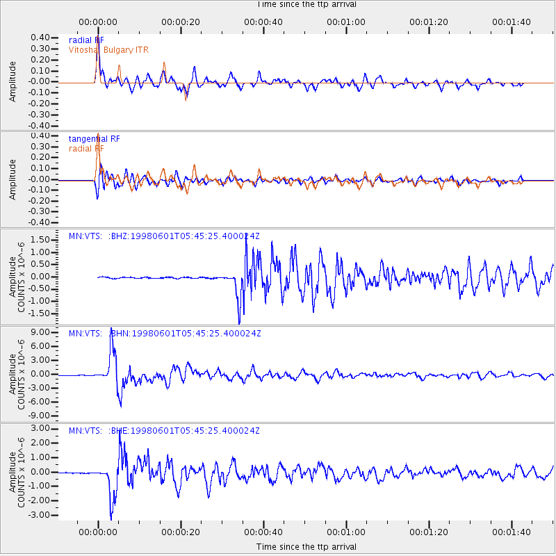
Earthquake location: Off East Coast Of Kamchatka
Earthquake latitude/longitude: 52.9/160.1
Earthquake time(UTC): 1998/06/01 (152) 05:34:03 GMT
Earthquake Depth: 44 km
Earthquake Magnitude: 6.2 MB, 6.3 MS, 6.5 UNKNOWN, 6.4 MW
Earthquake Catalog/Contributor: WHDF/NEIC
Network: MN MEDNET Project
Station: VTS Vitosha, Bulgary
Lat/Lon: 42.62 N/23.24 E
Elevation: 1490 m
Distance: 77.9 deg
Az: 328.898 deg
Baz: 25.09 deg
Ray Param: 0.04996689
Estimated Moho Depth: 37.25 km
Estimated Crust Vp/Vs: 1.75
Assumed Crust Vp: 6.291 km/s
Estimated Crust Vs: 3.585 km/s
Estimated Crust Poisson's Ratio: 0.26
Radial Match: 94.13296 %
Radial Bump: 400
Transverse Match: 89.1941 %
Transverse Bump: 400
SOD ConfigId: 4480
Insert Time: 2010-03-08 17:58:41.631 +0000
GWidth: 2.5
Max Bumps: 400
Tol: 0.001

Signal To Noise

ChannelStoNSTALTA
MN:VTS: :BHN:19980601T05:45:25.400024Z78.5216753.7438876E-64.7679674E-8
MN:VTS: :BHE:19980601T05:45:25.400024Z53.5611531.2436782E-62.321978E-8
MN:VTS: :BHZ:19980601T05:45:25.400024Z25.3559275.883131E-72.3202194E-8
Arrivals
Ps4.6 SECOND
PpPs16 SECOND
PsPs/PpSs20 SECOND