You are here: Home > Network List > PF - Volcanologic Network of Piton de Fournaise-OVPF Stations List
> Station HIM cratere Himiltrude > Earthquake Result Viewer
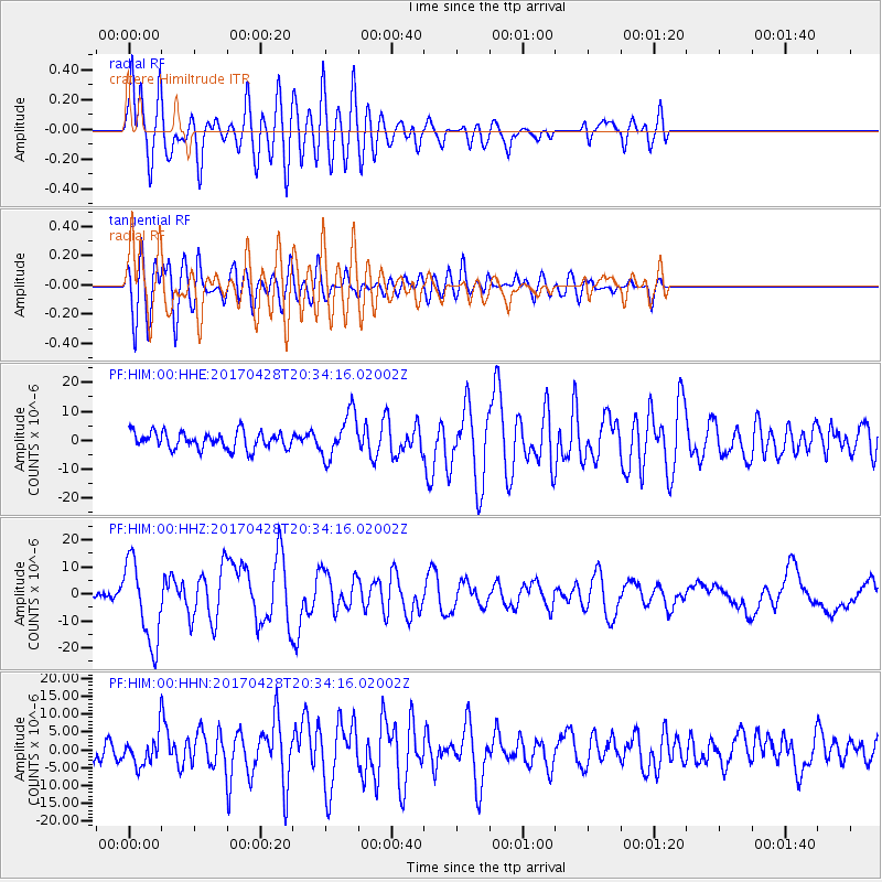
HIM cratere Himiltrude - Earthquake Result Viewer
*The percent match for this event was below the threshold and hence no stack was calculated.
| Earthquake location: |
Mindanao, Philippines |
| Earthquake latitude/longitude: |
5.5/125.1 |
| Earthquake time(UTC): |
2017/04/28 (118) 20:23:18 GMT |
| Earthquake Depth: |
10 km |
| Earthquake Magnitude: |
7.2 Mi |
| Earthquake Catalog/Contributor: |
NEIC PDE/pt |
|
| Network: |
PF Volcanologic Network of Piton de Fournaise-OVPF |
| Station: |
HIM cratere Himiltrude |
| Lat/Lon: |
21.21 S/55.72 E |
| Elevation: |
1958 m |
|
| Distance: |
72.9 deg |
| Az: |
245.967 deg |
| Baz: |
77.012 deg |
| Ray Param: |
$rayparam |
*The percent match for this event was below the threshold and hence was not used in the summary stack. |
|
| Radial Match: |
77.17723 % |
| Radial Bump: |
400 |
| Transverse Match: |
77.180756 % |
| Transverse Bump: |
400 |
| SOD ConfigId: |
2028011 |
| Insert Time: |
2017-05-12 20:30:54.079 +0000 |
| GWidth: |
2.5 |
| Max Bumps: |
400 |
| Tol: |
0.001 |
|
Signal To Noise
| Channel | StoN | STA | LTA |
| PF:HIM:00:HHZ:20170428T20:34:16.02002Z | 8.552086 | 1.5024786E-5 | 1.7568564E-6 |
| PF:HIM:00:HHN:20170428T20:34:16.02002Z | 1.0959771 | 3.8064923E-6 | 3.4731495E-6 |
| PF:HIM:00:HHE:20170428T20:34:16.02002Z | 2.6193633 | 7.686634E-6 | 2.9345429E-6 |
| Arrivals |
| Ps | |
| PpPs | |
| PsPs/PpSs | |


