You are here: Home > Network List > TS - TERRAscope (Southern California Seismic Network) Stations List
> Station PFO Pinon Flat, California, USA > Earthquake Result Viewer
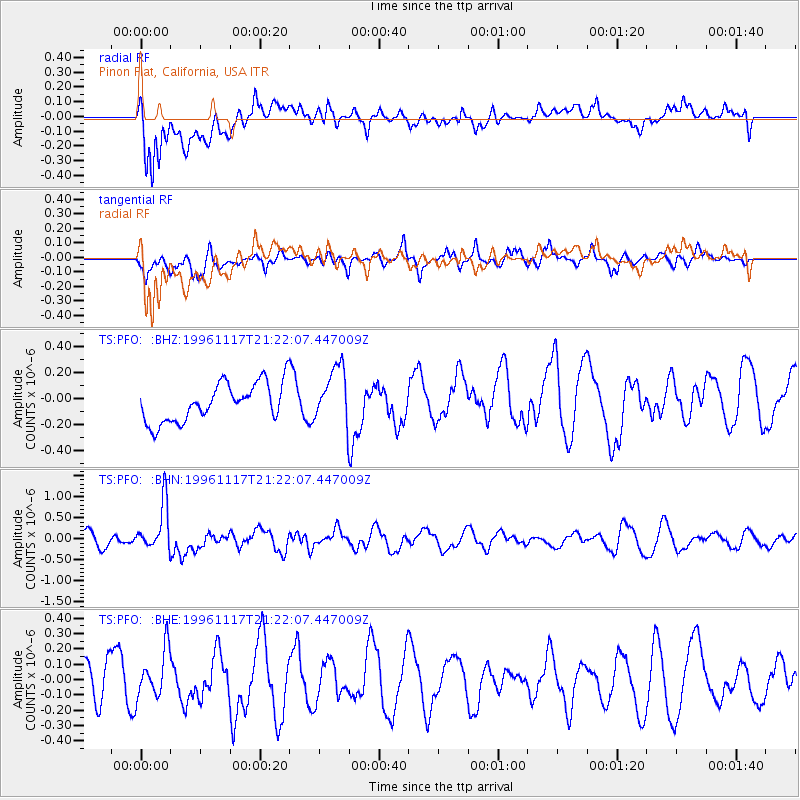
PFO Pinon Flat, California, USA - Earthquake Result Viewer
*The percent match for this event was below the threshold and hence no stack was calculated.
| Earthquake location: |
South Of Fiji Islands |
| Earthquake latitude/longitude: |
-22.2/-179.7 |
| Earthquake time(UTC): |
1996/11/17 (322) 21:11:20 GMT |
| Earthquake Depth: |
592 km |
| Earthquake Magnitude: |
5.5 MB, 6.1 UNKNOWN, 6.0 MW |
| Earthquake Catalog/Contributor: |
WHDF/NEIC |
|
| Network: |
TS TERRAscope (Southern California Seismic Network) |
| Station: |
PFO Pinon Flat, California, USA |
| Lat/Lon: |
33.61 N/116.46 W |
| Elevation: |
1280 m |
|
| Distance: |
81.9 deg |
| Az: |
48.83 deg |
| Baz: |
236.716 deg |
| Ray Param: |
$rayparam |
*The percent match for this event was below the threshold and hence was not used in the summary stack. |
|
| Radial Match: |
66.91267 % |
| Radial Bump: |
400 |
| Transverse Match: |
46.423 % |
| Transverse Bump: |
397 |
| SOD ConfigId: |
4480 |
| Insert Time: |
2010-02-26 14:43:08.064 +0000 |
| GWidth: |
2.5 |
| Max Bumps: |
400 |
| Tol: |
0.001 |
|
Signal To Noise
| Channel | StoN | STA | LTA |
| TS:PFO: :BHN:19961117T21:22:07.447009Z | 3.5447524 | 5.6029086E-7 | 1.5806206E-7 |
| TS:PFO: :BHE:19961117T21:22:07.447009Z | 1.7672236 | 1.5519372E-7 | 8.781782E-8 |
| TS:PFO: :BHZ:19961117T21:22:07.447009Z | 1.4759312 | 2.1784584E-7 | 1.4759891E-7 |
| Arrivals |
| Ps | |
| PpPs | |
| PsPs/PpSs | |


