You are here: Home > Network List > US - United States National Seismic Network Stations List
> Station LAO LASA Array, Montana, USA > Earthquake Result Viewer
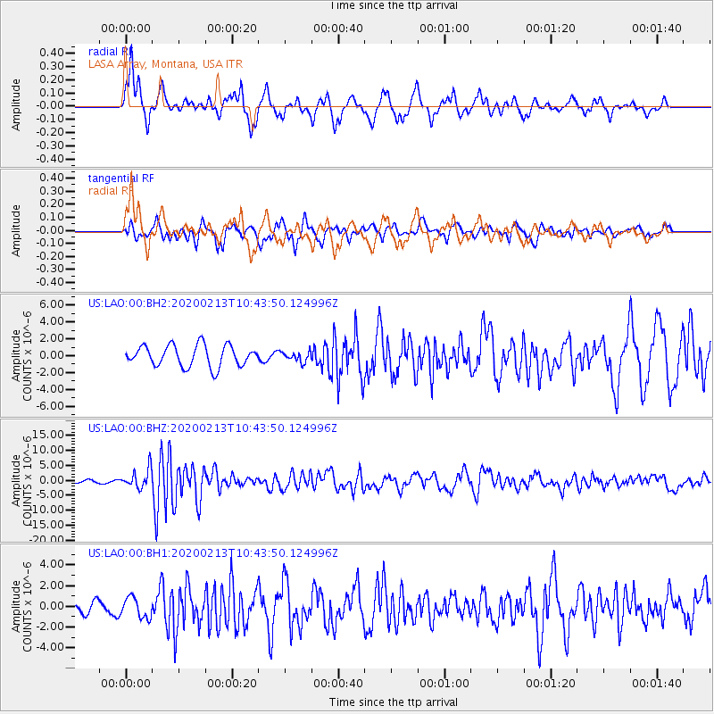
LAO LASA Array, Montana, USA - Earthquake Result Viewer
*The percent match for this event was below the threshold and hence no stack was calculated.
| Earthquake location: |
Kuril Islands |
| Earthquake latitude/longitude: |
45.6/148.9 |
| Earthquake time(UTC): |
2020/02/13 (044) 10:33:44 GMT |
| Earthquake Depth: |
144 km |
| Earthquake Magnitude: |
7.0 mww |
| Earthquake Catalog/Contributor: |
NEIC PDE/us |
|
| Network: |
US United States National Seismic Network |
| Station: |
LAO LASA Array, Montana, USA |
| Lat/Lon: |
46.69 N/106.22 W |
| Elevation: |
902 m |
|
| Distance: |
66.9 deg |
| Az: |
46.357 deg |
| Baz: |
312.473 deg |
| Ray Param: |
$rayparam |
*The percent match for this event was below the threshold and hence was not used in the summary stack. |
|
| Radial Match: |
75.89745 % |
| Radial Bump: |
326 |
| Transverse Match: |
64.01049 % |
| Transverse Bump: |
343 |
| SOD ConfigId: |
20792311 |
| Insert Time: |
2020-03-06 17:42:51.498 +0000 |
| GWidth: |
2.5 |
| Max Bumps: |
400 |
| Tol: |
0.001 |
|
Signal To Noise
| Channel | StoN | STA | LTA |
| US:LAO:00:BHZ:20200213T10:43:50.124996Z | 9.895049 | 3.260224E-6 | 3.2948034E-7 |
| US:LAO:00:BH1:20200213T10:43:50.124996Z | 1.1573699 | 9.825585E-7 | 8.4895817E-7 |
| US:LAO:00:BH2:20200213T10:43:50.124996Z | 0.47845158 | 5.9606197E-7 | 1.2458146E-6 |
| Arrivals |
| Ps | |
| PpPs | |
| PsPs/PpSs | |


