You are here: Home > Network List > US - United States National Seismic Network Stations List
> Station RLMT Red Lodge, Montana, USA > Earthquake Result Viewer
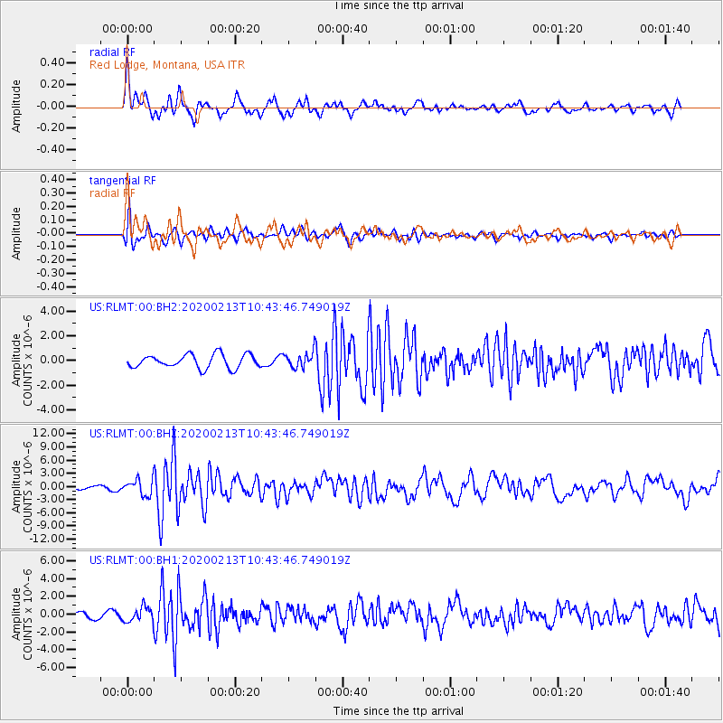
RLMT Red Lodge, Montana, USA - Earthquake Result Viewer
*The percent match for this event was below the threshold and hence no stack was calculated.
| Earthquake location: |
Kuril Islands |
| Earthquake latitude/longitude: |
45.6/148.9 |
| Earthquake time(UTC): |
2020/02/13 (044) 10:33:44 GMT |
| Earthquake Depth: |
144 km |
| Earthquake Magnitude: |
7.0 mww |
| Earthquake Catalog/Contributor: |
NEIC PDE/us |
|
| Network: |
US United States National Seismic Network |
| Station: |
RLMT Red Lodge, Montana, USA |
| Lat/Lon: |
45.12 N/109.27 W |
| Elevation: |
2086 m |
|
| Distance: |
66.3 deg |
| Az: |
49.174 deg |
| Baz: |
311.413 deg |
| Ray Param: |
$rayparam |
*The percent match for this event was below the threshold and hence was not used in the summary stack. |
|
| Radial Match: |
84.28369 % |
| Radial Bump: |
400 |
| Transverse Match: |
71.12806 % |
| Transverse Bump: |
400 |
| SOD ConfigId: |
20792311 |
| Insert Time: |
2020-03-06 17:44:24.015 +0000 |
| GWidth: |
2.5 |
| Max Bumps: |
400 |
| Tol: |
0.001 |
|
Signal To Noise
| Channel | StoN | STA | LTA |
| US:RLMT:00:BHZ:20200213T10:43:46.749019Z | 6.145139 | 1.8351037E-6 | 2.9862687E-7 |
| US:RLMT:00:BH1:20200213T10:43:46.749019Z | 2.6593268 | 8.4212144E-7 | 3.1666715E-7 |
| US:RLMT:00:BH2:20200213T10:43:46.749019Z | 1.1411484 | 6.248323E-7 | 5.475469E-7 |
| Arrivals |
| Ps | |
| PpPs | |
| PsPs/PpSs | |


