You are here: Home > Network List > TS - TERRAscope (Southern California Seismic Network) Stations List
> Station PFO Pinon Flat, California, USA > Earthquake Result Viewer
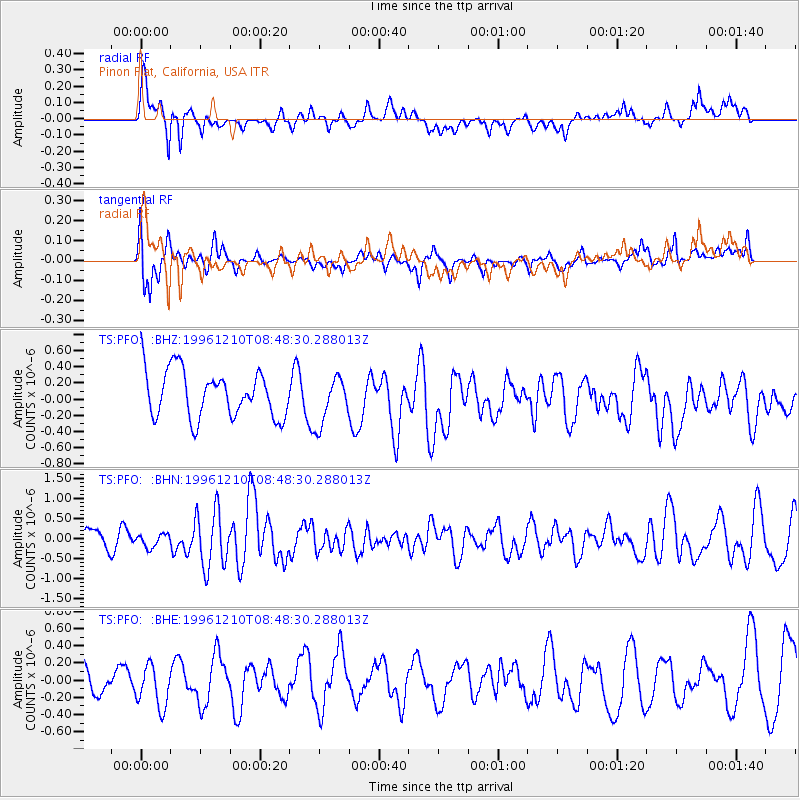
PFO Pinon Flat, California, USA - Earthquake Result Viewer
*The percent match for this event was below the threshold and hence no stack was calculated.
| Earthquake location: |
Central Mid-Atlantic Ridge |
| Earthquake latitude/longitude: |
0.9/-30.0 |
| Earthquake time(UTC): |
1996/12/10 (345) 08:36:18 GMT |
| Earthquake Depth: |
10 km |
| Earthquake Magnitude: |
6.0 MB, 6.2 MS, 6.6 UNKNOWN, 6.6 MW |
| Earthquake Catalog/Contributor: |
WHDF/NEIC |
|
| Network: |
TS TERRAscope (Southern California Seismic Network) |
| Station: |
PFO Pinon Flat, California, USA |
| Lat/Lon: |
33.61 N/116.46 W |
| Elevation: |
1280 m |
|
| Distance: |
86.5 deg |
| Az: |
303.443 deg |
| Baz: |
91.254 deg |
| Ray Param: |
$rayparam |
*The percent match for this event was below the threshold and hence was not used in the summary stack. |
|
| Radial Match: |
69.1961 % |
| Radial Bump: |
400 |
| Transverse Match: |
53.04715 % |
| Transverse Bump: |
400 |
| SOD ConfigId: |
4480 |
| Insert Time: |
2010-02-26 14:43:09.553 +0000 |
| GWidth: |
2.5 |
| Max Bumps: |
400 |
| Tol: |
0.001 |
|
Signal To Noise
| Channel | StoN | STA | LTA |
| TS:PFO: :BHN:19961210T08:48:30.288013Z | 0.62196815 | 1.6417879E-7 | 2.6396654E-7 |
| TS:PFO: :BHE:19961210T08:48:30.288013Z | 1.8955029 | 2.5071304E-7 | 1.322673E-7 |
| TS:PFO: :BHZ:19961210T08:48:30.288013Z | 1.0244887 | 2.9736208E-7 | 2.9025412E-7 |
| Arrivals |
| Ps | |
| PpPs | |
| PsPs/PpSs | |


