You are here: Home > Network List > UU - University of Utah Regional Network Stations List
> Station FOR4 Blundell West, UT, USA > Earthquake Result Viewer
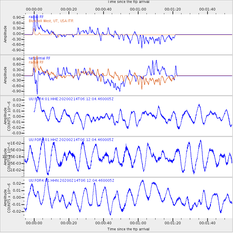
FOR4 Blundell West, UT, USA - Earthquake Result Viewer
*The percent match for this event was below the threshold and hence no stack was calculated.
| Earthquake location: |
Pacific-Antarctic Ridge |
| Earthquake latitude/longitude: |
-56.6/-142.3 |
| Earthquake time(UTC): |
2020/02/14 (045) 05:59:00 GMT |
| Earthquake Depth: |
10 km |
| Earthquake Magnitude: |
5.5 Mww |
| Earthquake Catalog/Contributor: |
NEIC PDE/us |
|
| Network: |
UU University of Utah Regional Network |
| Station: |
FOR4 Blundell West, UT, USA |
| Lat/Lon: |
38.50 N/112.90 W |
| Elevation: |
1657 m |
|
| Distance: |
98.0 deg |
| Az: |
22.88 deg |
| Baz: |
195.892 deg |
| Ray Param: |
$rayparam |
*The percent match for this event was below the threshold and hence was not used in the summary stack. |
|
| Radial Match: |
57.377934 % |
| Radial Bump: |
400 |
| Transverse Match: |
58.691914 % |
| Transverse Bump: |
400 |
| SOD ConfigId: |
20792311 |
| Insert Time: |
2020-03-07 13:00:31.563 +0000 |
| GWidth: |
2.5 |
| Max Bumps: |
400 |
| Tol: |
0.001 |
|
Signal To Noise
| Channel | StoN | STA | LTA |
| UU:FOR4:01:HHZ:20200214T06:12:04.460005Z | 1.0563321 | 7.028834E-9 | 6.654E-9 |
| UU:FOR4:01:HHN:20200214T06:12:04.460005Z | 0.9738501 | 1.1669939E-8 | 1.19833015E-8 |
| UU:FOR4:01:HHE:20200214T06:12:04.460005Z | 0.9095524 | 1.0812046E-8 | 1.18872165E-8 |
| Arrivals |
| Ps | |
| PpPs | |
| PsPs/PpSs | |


