You are here: Home > Network List > TA - USArray Transportable Network (new EarthScope stations) Stations List
> Station G21K Allakaket, AK, USA > Earthquake Result Viewer
G21K Allakaket, AK, USA - Earthquake Result Viewer
*The percent match for this event was below the threshold and hence no stack was calculated.
| Earthquake location: |
Taiwan |
| Earthquake latitude/longitude: |
23.8/121.5 |
| Earthquake time(UTC): |
2020/02/15 (046) 11:00:06 GMT |
| Earthquake Depth: |
10 km |
| Earthquake Magnitude: |
5.7 mb |
| Earthquake Catalog/Contributor: |
NEIC PDE/us |
|
| Network: |
TA USArray Transportable Network (new EarthScope stations) |
| Station: |
G21K Allakaket, AK, USA |
| Lat/Lon: |
66.52 N/153.51 W |
| Elevation: |
446 m |
|
| Distance: |
66.4 deg |
| Az: |
25.829 deg |
| Baz: |
275.469 deg |
| Ray Param: |
$rayparam |
*The percent match for this event was below the threshold and hence was not used in the summary stack. |
|
| Radial Match: |
68.65818 % |
| Radial Bump: |
400 |
| Transverse Match: |
62.305992 % |
| Transverse Bump: |
366 |
| SOD ConfigId: |
20792311 |
| Insert Time: |
2020-03-09 01:08:26.930 +0000 |
| GWidth: |
2.5 |
| Max Bumps: |
400 |
| Tol: |
0.001 |
|
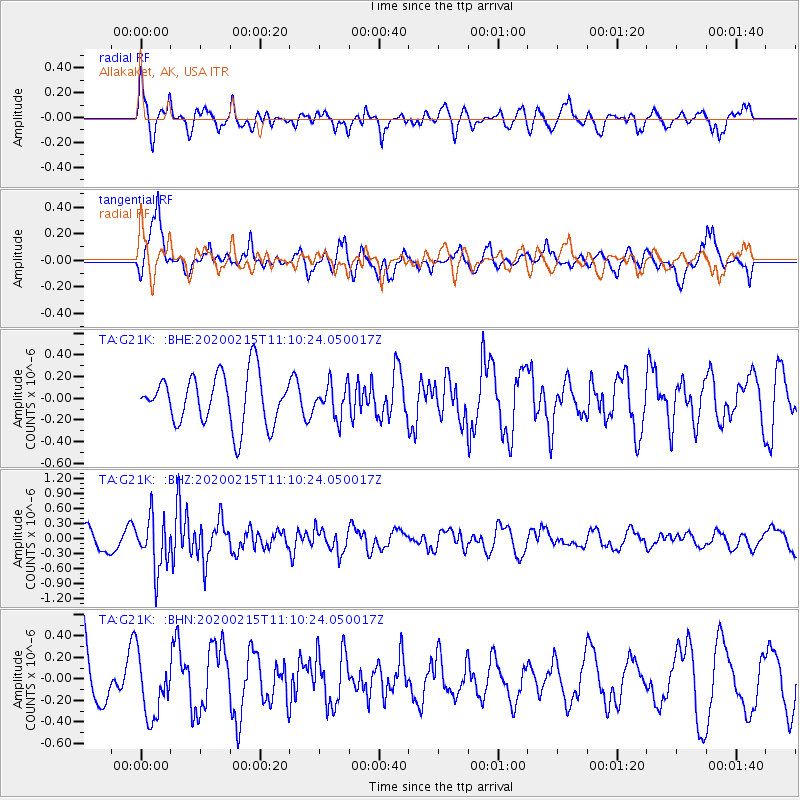
Signal To Noise
| Channel | StoN | STA | LTA |
| TA:G21K: :BHZ:20200215T11:10:24.050017Z | 2.1730163 | 5.1832336E-7 | 2.3852715E-7 |
| TA:G21K: :BHN:20200215T11:10:24.050017Z | 0.9807386 | 2.893662E-7 | 2.950493E-7 |
| TA:G21K: :BHE:20200215T11:10:24.050017Z | 0.6487032 | 1.5085358E-7 | 2.3254638E-7 |
| Arrivals |
| Ps | |
| PpPs | |
| PsPs/PpSs | |


