You are here: Home > Network List > TA - USArray Transportable Network (new EarthScope stations) Stations List
> Station I30M Mount Dempster, Yukon, CAN > Earthquake Result Viewer
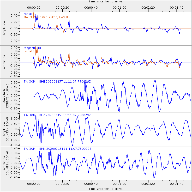
I30M Mount Dempster, Yukon, CAN - Earthquake Result Viewer
*The percent match for this event was below the threshold and hence no stack was calculated.
| Earthquake location: |
Taiwan |
| Earthquake latitude/longitude: |
23.8/121.5 |
| Earthquake time(UTC): |
2020/02/15 (046) 11:00:06 GMT |
| Earthquake Depth: |
10 km |
| Earthquake Magnitude: |
5.7 mb |
| Earthquake Catalog/Contributor: |
NEIC PDE/us |
|
| Network: |
TA USArray Transportable Network (new EarthScope stations) |
| Station: |
I30M Mount Dempster, Yukon, CAN |
| Lat/Lon: |
65.22 N/136.38 W |
| Elevation: |
1399 m |
|
| Distance: |
73.5 deg |
| Az: |
25.451 deg |
| Baz: |
290.975 deg |
| Ray Param: |
$rayparam |
*The percent match for this event was below the threshold and hence was not used in the summary stack. |
|
| Radial Match: |
86.05586 % |
| Radial Bump: |
391 |
| Transverse Match: |
67.929016 % |
| Transverse Bump: |
400 |
| SOD ConfigId: |
20792311 |
| Insert Time: |
2020-03-09 01:10:23.192 +0000 |
| GWidth: |
2.5 |
| Max Bumps: |
400 |
| Tol: |
0.001 |
|
Signal To Noise
| Channel | StoN | STA | LTA |
| TA:I30M: :BHZ:20200215T11:11:07.750029Z | 1.6968051 | 6.3631876E-7 | 3.7500993E-7 |
| TA:I30M: :BHN:20200215T11:11:07.750029Z | 1.7765317 | 4.7033285E-7 | 2.647478E-7 |
| TA:I30M: :BHE:20200215T11:11:07.750029Z | 0.8814208 | 2.2127422E-7 | 2.5104265E-7 |
| Arrivals |
| Ps | |
| PpPs | |
| PsPs/PpSs | |


