You are here: Home > Network List > GO - National Seismic Network of Georgia Stations List
> Station TBLG Delisi, Georgia > Earthquake Result Viewer
TBLG Delisi, Georgia - Earthquake Result Viewer
*The percent match for this event was below the threshold and hence no stack was calculated.
| Earthquake location: |
Northern Molucca Sea |
| Earthquake latitude/longitude: |
1.6/126.6 |
| Earthquake time(UTC): |
2020/02/15 (046) 15:36:41 GMT |
| Earthquake Depth: |
10 km |
| Earthquake Magnitude: |
5.4 Mww |
| Earthquake Catalog/Contributor: |
NEIC PDE/us |
|
| Network: |
GO National Seismic Network of Georgia |
| Station: |
TBLG Delisi, Georgia |
| Lat/Lon: |
41.73 N/44.74 E |
| Elevation: |
510 m |
|
| Distance: |
82.8 deg |
| Az: |
311.692 deg |
| Baz: |
94.241 deg |
| Ray Param: |
$rayparam |
*The percent match for this event was below the threshold and hence was not used in the summary stack. |
|
| Radial Match: |
50.039776 % |
| Radial Bump: |
400 |
| Transverse Match: |
51.359318 % |
| Transverse Bump: |
400 |
| SOD ConfigId: |
20792311 |
| Insert Time: |
2020-03-10 00:53:44.404 +0000 |
| GWidth: |
2.5 |
| Max Bumps: |
400 |
| Tol: |
0.001 |
|
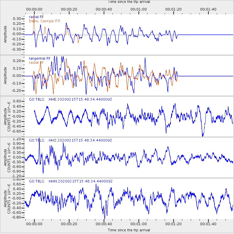
Signal To Noise
| Channel | StoN | STA | LTA |
| GO:TBLG: :HHZ:20200215T15:48:34.440009Z | 2.4906654 | 3.570637E-7 | 1.4336077E-7 |
| GO:TBLG: :HHN:20200215T15:48:34.440009Z | 1.2028438 | 2.5012127E-7 | 2.079416E-7 |
| GO:TBLG: :HHE:20200215T15:48:34.440009Z | 0.98329246 | 1.8326496E-7 | 1.8637888E-7 |
| Arrivals |
| Ps | |
| PpPs | |
| PsPs/PpSs | |


