You are here: Home > Network List > MN - MEDNET Project Stations List
> Station VTS Vitosha, Bulgary > Earthquake Result Viewer
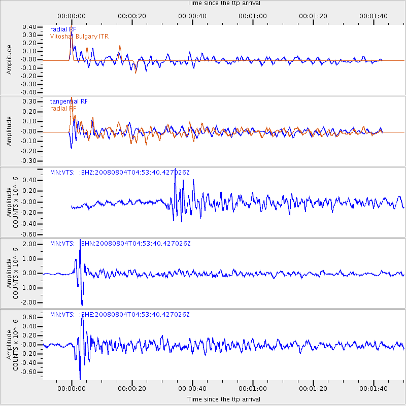
VTS Vitosha, Bulgary - Earthquake Result Viewer
*The percent match for this event was below the threshold and hence no stack was calculated.
| Earthquake location: |
Kuril Islands |
| Earthquake latitude/longitude: |
49.9/156.4 |
| Earthquake time(UTC): |
2008/08/04 (217) 04:42:14 GMT |
| Earthquake Depth: |
77 km |
| Earthquake Magnitude: |
5.6 MB, 5.8 MW, 5.7 MW |
| Earthquake Catalog/Contributor: |
WHDF/NEIC |
|
| Network: |
MN MEDNET Project |
| Station: |
VTS Vitosha, Bulgary |
| Lat/Lon: |
42.62 N/23.24 E |
| Elevation: |
1490 m |
|
| Distance: |
79.2 deg |
| Az: |
326.75 deg |
| Baz: |
28.738 deg |
| Ray Param: |
$rayparam |
*The percent match for this event was below the threshold and hence was not used in the summary stack. |
|
| Radial Match: |
78.61163 % |
| Radial Bump: |
400 |
| Transverse Match: |
83.01894 % |
| Transverse Bump: |
391 |
| SOD ConfigId: |
2504 |
| Insert Time: |
2010-03-08 18:00:36.065 +0000 |
| GWidth: |
2.5 |
| Max Bumps: |
400 |
| Tol: |
0.001 |
|
Signal To Noise
| Channel | StoN | STA | LTA |
| MN:VTS: :BHN:20080804T04:53:40.427026Z | 22.448406 | 9.312868E-7 | 4.1485652E-8 |
| MN:VTS: :BHE:20080804T04:53:40.427026Z | 10.315216 | 3.127247E-7 | 3.0316833E-8 |
| MN:VTS: :BHZ:20080804T04:53:40.427026Z | 4.2102 | 1.7734727E-7 | 4.2123244E-8 |
| Arrivals |
| Ps | |
| PpPs | |
| PsPs/PpSs | |


