You are here: Home > Network List > TA - USArray Transportable Network (new EarthScope stations) Stations List
> Station I30M Mount Dempster, Yukon, CAN > Earthquake Result Viewer
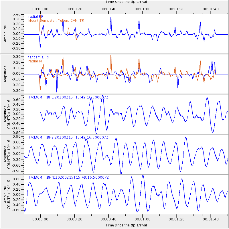
I30M Mount Dempster, Yukon, CAN - Earthquake Result Viewer
*The percent match for this event was below the threshold and hence no stack was calculated.
| Earthquake location: |
Northern Molucca Sea |
| Earthquake latitude/longitude: |
1.6/126.6 |
| Earthquake time(UTC): |
2020/02/15 (046) 15:36:41 GMT |
| Earthquake Depth: |
10 km |
| Earthquake Magnitude: |
5.4 Mww |
| Earthquake Catalog/Contributor: |
NEIC PDE/us |
|
| Network: |
TA USArray Transportable Network (new EarthScope stations) |
| Station: |
I30M Mount Dempster, Yukon, CAN |
| Lat/Lon: |
65.22 N/136.38 W |
| Elevation: |
1399 m |
|
| Distance: |
91.5 deg |
| Az: |
24.732 deg |
| Baz: |
277.066 deg |
| Ray Param: |
$rayparam |
*The percent match for this event was below the threshold and hence was not used in the summary stack. |
|
| Radial Match: |
57.07101 % |
| Radial Bump: |
400 |
| Transverse Match: |
69.06627 % |
| Transverse Bump: |
400 |
| SOD ConfigId: |
20792311 |
| Insert Time: |
2020-03-10 01:34:10.587 +0000 |
| GWidth: |
2.5 |
| Max Bumps: |
400 |
| Tol: |
0.001 |
|
Signal To Noise
| Channel | StoN | STA | LTA |
| TA:I30M: :BHZ:20200215T15:49:16.500007Z | 1.0881863 | 3.6297723E-7 | 3.335617E-7 |
| TA:I30M: :BHN:20200215T15:49:16.500007Z | 0.4695978 | 1.3701718E-7 | 2.917756E-7 |
| TA:I30M: :BHE:20200215T15:49:16.500007Z | 3.3020236 | 5.473902E-7 | 1.6577417E-7 |
| Arrivals |
| Ps | |
| PpPs | |
| PsPs/PpSs | |


