You are here: Home > Network List > TA - USArray Transportable Network (new EarthScope stations) Stations List
> Station D25K Kavik River, AK, USA > Earthquake Result Viewer
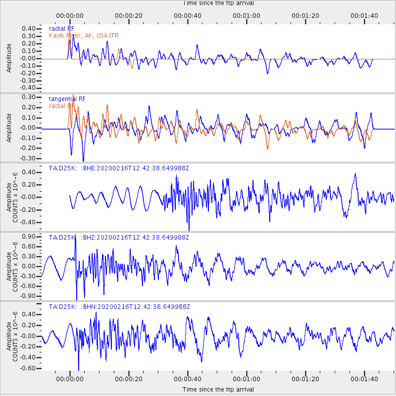
D25K Kavik River, AK, USA - Earthquake Result Viewer
*The percent match for this event was below the threshold and hence no stack was calculated.
| Earthquake location: |
Southern Iran |
| Earthquake latitude/longitude: |
27.1/55.8 |
| Earthquake time(UTC): |
2020/02/16 (047) 12:30:47 GMT |
| Earthquake Depth: |
10 km |
| Earthquake Magnitude: |
5.1 Mww |
| Earthquake Catalog/Contributor: |
NEIC PDE/us |
|
| Network: |
TA USArray Transportable Network (new EarthScope stations) |
| Station: |
D25K Kavik River, AK, USA |
| Lat/Lon: |
69.32 N/146.38 W |
| Elevation: |
770 m |
|
| Distance: |
82.5 deg |
| Az: |
7.761 deg |
| Baz: |
340.189 deg |
| Ray Param: |
$rayparam |
*The percent match for this event was below the threshold and hence was not used in the summary stack. |
|
| Radial Match: |
53.513268 % |
| Radial Bump: |
400 |
| Transverse Match: |
65.87002 % |
| Transverse Bump: |
400 |
| SOD ConfigId: |
20831131 |
| Insert Time: |
2020-03-13 00:23:32.329 +0000 |
| GWidth: |
2.5 |
| Max Bumps: |
400 |
| Tol: |
0.001 |
|
Signal To Noise
| Channel | StoN | STA | LTA |
| TA:D25K: :BHZ:20200216T12:42:38.649988Z | 2.3124228 | 3.678754E-7 | 1.5908657E-7 |
| TA:D25K: :BHN:20200216T12:42:38.649988Z | 2.1052563 | 1.9037856E-7 | 9.0430106E-8 |
| TA:D25K: :BHE:20200216T12:42:38.649988Z | 0.9712979 | 9.239996E-8 | 9.51304E-8 |
| Arrivals |
| Ps | |
| PpPs | |
| PsPs/PpSs | |


