You are here: Home > Network List > TA - USArray Transportable Network (new EarthScope stations) Stations List
> Station K15K Wolf Creek Mountain, AK, USA > Earthquake Result Viewer
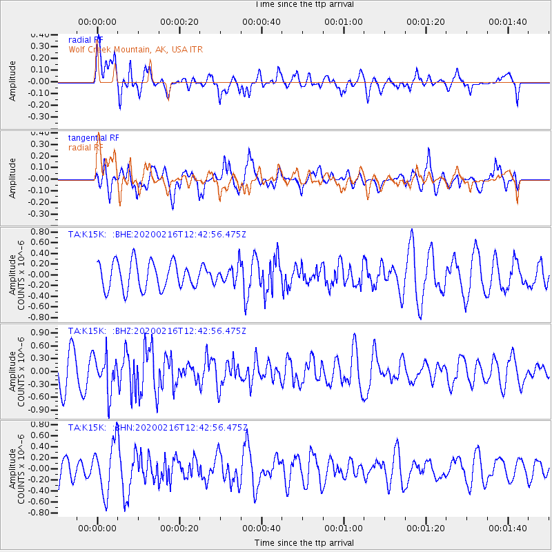
K15K Wolf Creek Mountain, AK, USA - Earthquake Result Viewer
*The percent match for this event was below the threshold and hence no stack was calculated.
| Earthquake location: |
Southern Iran |
| Earthquake latitude/longitude: |
27.1/55.8 |
| Earthquake time(UTC): |
2020/02/16 (047) 12:30:47 GMT |
| Earthquake Depth: |
10 km |
| Earthquake Magnitude: |
5.1 Mww |
| Earthquake Catalog/Contributor: |
NEIC PDE/us |
|
| Network: |
TA USArray Transportable Network (new EarthScope stations) |
| Station: |
K15K Wolf Creek Mountain, AK, USA |
| Lat/Lon: |
62.29 N/161.53 W |
| Elevation: |
346 m |
|
| Distance: |
86.0 deg |
| Az: |
16.494 deg |
| Baz: |
327.214 deg |
| Ray Param: |
$rayparam |
*The percent match for this event was below the threshold and hence was not used in the summary stack. |
|
| Radial Match: |
57.640198 % |
| Radial Bump: |
400 |
| Transverse Match: |
54.776787 % |
| Transverse Bump: |
385 |
| SOD ConfigId: |
20831131 |
| Insert Time: |
2020-03-13 00:29:30.974 +0000 |
| GWidth: |
2.5 |
| Max Bumps: |
400 |
| Tol: |
0.001 |
|
Signal To Noise
| Channel | StoN | STA | LTA |
| TA:K15K: :BHZ:20200216T12:42:56.475Z | 1.502656 | 4.1684248E-7 | 2.7740379E-7 |
| TA:K15K: :BHN:20200216T12:42:56.475Z | 2.7346694 | 4.699754E-7 | 1.718582E-7 |
| TA:K15K: :BHE:20200216T12:42:56.475Z | 0.66502154 | 1.6837332E-7 | 2.5318477E-7 |
| Arrivals |
| Ps | |
| PpPs | |
| PsPs/PpSs | |


