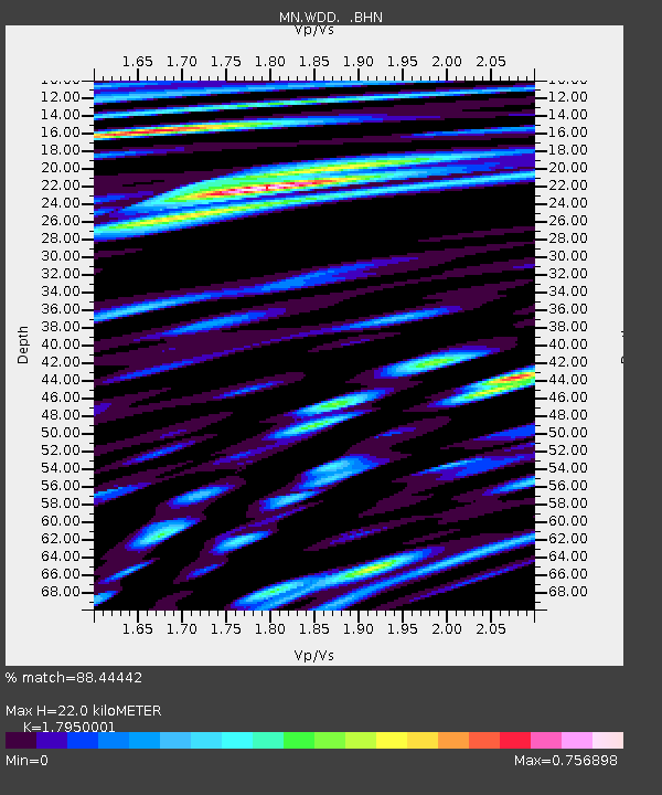
WDD Wield Dalam, Malta - Earthquake Result Viewer
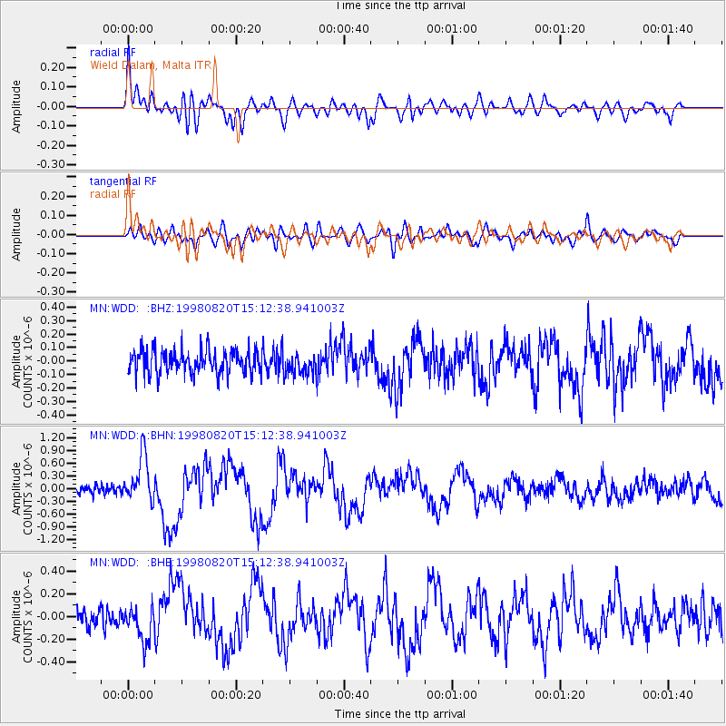
Earthquake location: Rat Islands, Aleutian Islands
Earthquake latitude/longitude: 51.6/175.2
Earthquake time(UTC): 1998/08/20 (232) 15:00:08 GMT
Earthquake Depth: 33 km
Earthquake Magnitude: 5.6 MB, 6.0 MS, 6.2 UNKNOWN, 6.2 MW
Earthquake Catalog/Contributor: WHDF/NEIC
Network: MN MEDNET Project
Station: WDD Wield Dalam, Malta
Lat/Lon: 35.87 N/14.52 E
Elevation: 41 m
Distance: 91.3 deg
Az: 344.444 deg
Baz: 11.88 deg
Ray Param: 0.04161096
Estimated Moho Depth: 22.0 km
Estimated Crust Vp/Vs: 1.80
Assumed Crust Vp: 4.05 km/s
Estimated Crust Vs: 2.256 km/s
Estimated Crust Poisson's Ratio: 0.27
Radial Match: 88.44442 %
Radial Bump: 400
Transverse Match: 75.91922 %
Transverse Bump: 400
SOD ConfigId: 4480
Insert Time: 2010-03-08 18:01:19.833 +0000
GWidth: 2.5
Max Bumps: 400
Tol: 0.001

Signal To Noise

ChannelStoNSTALTA
MN:WDD: :BHN:19980820T15:12:38.941003Z5.0627555.443285E-71.0751626E-7
MN:WDD: :BHE:19980820T15:12:38.941003Z1.83654141.5631385E-78.5113165E-8
MN:WDD: :BHZ:19980820T15:12:38.941003Z0.86088277.588086E-88.8143096E-8
Arrivals
Ps4.4 SECOND
PpPs15 SECOND
PsPs/PpSs19 SECOND