You are here: Home > Network List > AZ - ANZA Regional Network Stations List
> Station SMER AZ.SMER > Earthquake Result Viewer
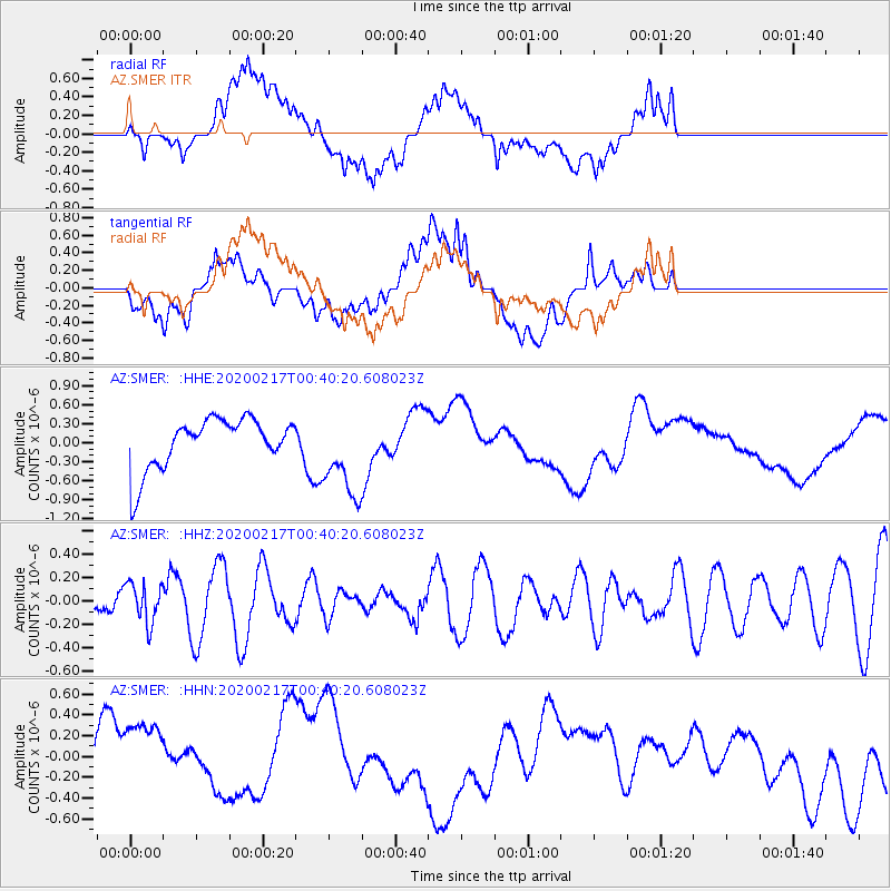
SMER AZ.SMER - Earthquake Result Viewer
*The percent match for this event was below the threshold and hence no stack was calculated.
| Earthquake location: |
South Of Kermadec Islands |
| Earthquake latitude/longitude: |
-33.1/179.9 |
| Earthquake time(UTC): |
2020/02/17 (048) 00:28:15 GMT |
| Earthquake Depth: |
149 km |
| Earthquake Magnitude: |
5.5 Mww |
| Earthquake Catalog/Contributor: |
NEIC PDE/us |
|
| Network: |
AZ ANZA Regional Network |
| Station: |
SMER AZ.SMER |
| Lat/Lon: |
33.46 N/117.17 W |
| Elevation: |
355 m |
|
| Distance: |
88.7 deg |
| Az: |
48.096 deg |
| Baz: |
228.371 deg |
| Ray Param: |
$rayparam |
*The percent match for this event was below the threshold and hence was not used in the summary stack. |
|
| Radial Match: |
54.7445 % |
| Radial Bump: |
400 |
| Transverse Match: |
39.88006 % |
| Transverse Bump: |
400 |
| SOD ConfigId: |
20831131 |
| Insert Time: |
2020-03-13 18:00:27.435 +0000 |
| GWidth: |
2.5 |
| Max Bumps: |
400 |
| Tol: |
0.001 |
|
Signal To Noise
| Channel | StoN | STA | LTA |
| AZ:SMER: :HHZ:20200217T00:40:20.608023Z | 0.6555802 | 1.7048428E-7 | 2.60051E-7 |
| AZ:SMER: :HHN:20200217T00:40:20.608023Z | 1.6395113 | 5.0985363E-7 | 3.1097903E-7 |
| AZ:SMER: :HHE:20200217T00:40:20.608023Z | 1.6425177 | 6.671475E-7 | 4.061737E-7 |
| Arrivals |
| Ps | |
| PpPs | |
| PsPs/PpSs | |


