You are here: Home > Network List > IU - Global Seismograph Network (GSN - IRIS/USGS) Stations List
> Station PMG Port Moresby, New Guinea > Earthquake Result Viewer
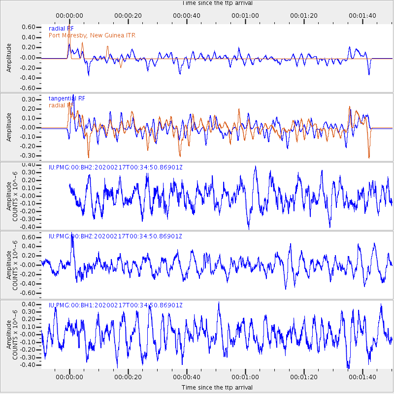
PMG Port Moresby, New Guinea - Earthquake Result Viewer
*The percent match for this event was below the threshold and hence no stack was calculated.
| Earthquake location: |
South Of Kermadec Islands |
| Earthquake latitude/longitude: |
-33.1/179.9 |
| Earthquake time(UTC): |
2020/02/17 (048) 00:28:15 GMT |
| Earthquake Depth: |
149 km |
| Earthquake Magnitude: |
5.5 Mww |
| Earthquake Catalog/Contributor: |
NEIC PDE/us |
|
| Network: |
IU Global Seismograph Network (GSN - IRIS/USGS) |
| Station: |
PMG Port Moresby, New Guinea |
| Lat/Lon: |
9.40 S/147.16 E |
| Elevation: |
90 m |
|
| Distance: |
38.3 deg |
| Az: |
300.464 deg |
| Baz: |
132.827 deg |
| Ray Param: |
$rayparam |
*The percent match for this event was below the threshold and hence was not used in the summary stack. |
|
| Radial Match: |
53.94576 % |
| Radial Bump: |
400 |
| Transverse Match: |
49.89042 % |
| Transverse Bump: |
400 |
| SOD ConfigId: |
20831131 |
| Insert Time: |
2020-03-13 19:25:24.875 +0000 |
| GWidth: |
2.5 |
| Max Bumps: |
400 |
| Tol: |
0.001 |
|
Signal To Noise
| Channel | StoN | STA | LTA |
| IU:PMG:00:BHZ:20200217T00:34:50.86901Z | 2.7744153 | 2.7722353E-7 | 9.992144E-8 |
| IU:PMG:00:BH1:20200217T00:34:50.86901Z | 0.9333478 | 1.239206E-7 | 1.3277001E-7 |
| IU:PMG:00:BH2:20200217T00:34:50.86901Z | 0.936963 | 1.16292284E-7 | 1.241162E-7 |
| Arrivals |
| Ps | |
| PpPs | |
| PsPs/PpSs | |


