You are here: Home > Network List > UW - Pacific Northwest Regional Seismic Network Stations List
> Station HOOD Mt Hood Meadows, OR CREST BB SMO > Earthquake Result Viewer
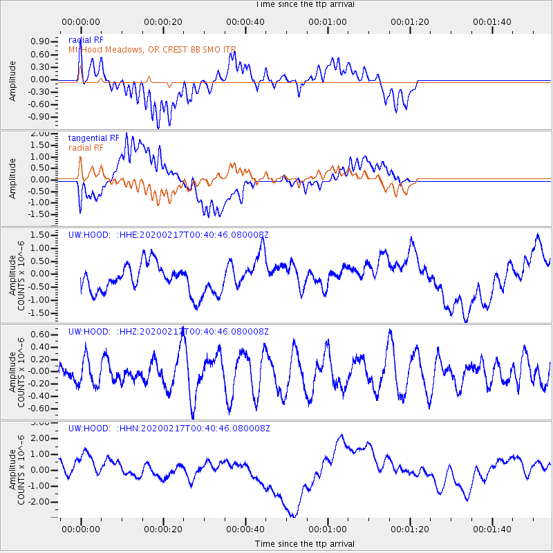
HOOD Mt Hood Meadows, OR CREST BB SMO - Earthquake Result Viewer
*The percent match for this event was below the threshold and hence no stack was calculated.
| Earthquake location: |
South Of Kermadec Islands |
| Earthquake latitude/longitude: |
-33.1/179.9 |
| Earthquake time(UTC): |
2020/02/17 (048) 00:28:15 GMT |
| Earthquake Depth: |
149 km |
| Earthquake Magnitude: |
5.5 Mww |
| Earthquake Catalog/Contributor: |
NEIC PDE/us |
|
| Network: |
UW Pacific Northwest Regional Seismic Network |
| Station: |
HOOD Mt Hood Meadows, OR CREST BB SMO |
| Lat/Lon: |
45.32 N/121.65 W |
| Elevation: |
1520 m |
|
| Distance: |
94.3 deg |
| Az: |
37.054 deg |
| Baz: |
225.815 deg |
| Ray Param: |
$rayparam |
*The percent match for this event was below the threshold and hence was not used in the summary stack. |
|
| Radial Match: |
36.958904 % |
| Radial Bump: |
400 |
| Transverse Match: |
46.977573 % |
| Transverse Bump: |
400 |
| SOD ConfigId: |
20831131 |
| Insert Time: |
2020-03-13 20:19:01.554 +0000 |
| GWidth: |
2.5 |
| Max Bumps: |
400 |
| Tol: |
0.001 |
|
Signal To Noise
| Channel | StoN | STA | LTA |
| UW:HOOD: :HHZ:20200217T00:40:46.080008Z | 0.859371 | 2.2548976E-7 | 2.6238928E-7 |
| UW:HOOD: :HHN:20200217T00:40:46.080008Z | 2.8423214 | 9.5018567E-7 | 3.3429916E-7 |
| UW:HOOD: :HHE:20200217T00:40:46.080008Z | 1.4365082 | 6.673735E-7 | 4.6458035E-7 |
| Arrivals |
| Ps | |
| PpPs | |
| PsPs/PpSs | |


