You are here: Home > Network List > CI - Caltech Regional Seismic Network Stations List
> Station SWS Sam W. Stewart, Westmorland, CA, USA > Earthquake Result Viewer
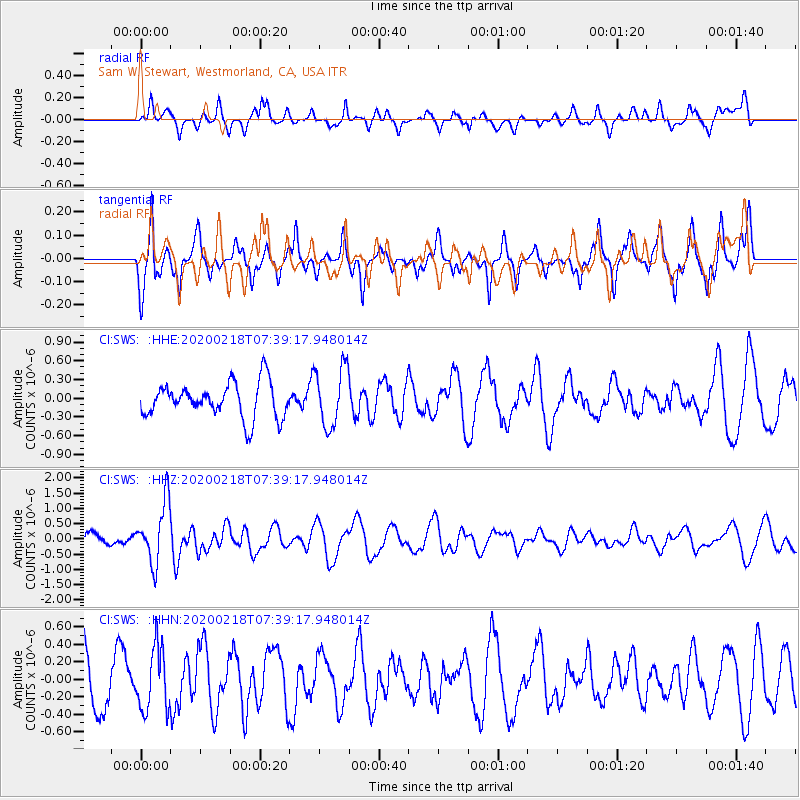
SWS Sam W. Stewart, Westmorland, CA, USA - Earthquake Result Viewer
*The percent match for this event was below the threshold and hence no stack was calculated.
| Earthquake location: |
North Of Svalbard |
| Earthquake latitude/longitude: |
85.7/22.7 |
| Earthquake time(UTC): |
2020/02/18 (049) 07:29:39 GMT |
| Earthquake Depth: |
10 km |
| Earthquake Magnitude: |
5.2 Mww |
| Earthquake Catalog/Contributor: |
NEIC PDE/us |
|
| Network: |
CI Caltech Regional Seismic Network |
| Station: |
SWS Sam W. Stewart, Westmorland, CA, USA |
| Lat/Lon: |
32.94 N/115.80 W |
| Elevation: |
140 m |
|
| Distance: |
60.5 deg |
| Az: |
320.184 deg |
| Baz: |
3.264 deg |
| Ray Param: |
$rayparam |
*The percent match for this event was below the threshold and hence was not used in the summary stack. |
|
| Radial Match: |
67.06066 % |
| Radial Bump: |
400 |
| Transverse Match: |
75.93929 % |
| Transverse Bump: |
338 |
| SOD ConfigId: |
20831131 |
| Insert Time: |
2020-03-15 20:33:28.763 +0000 |
| GWidth: |
2.5 |
| Max Bumps: |
400 |
| Tol: |
0.001 |
|
Signal To Noise
| Channel | StoN | STA | LTA |
| CI:SWS: :HHZ:20200218T07:39:17.948014Z | 6.661615 | 9.902354E-7 | 1.4864796E-7 |
| CI:SWS: :HHN:20200218T07:39:17.948014Z | 1.4005926 | 3.6154654E-7 | 2.5813827E-7 |
| CI:SWS: :HHE:20200218T07:39:17.948014Z | 1.7045358 | 4.7518543E-7 | 2.7877704E-7 |
| Arrivals |
| Ps | |
| PpPs | |
| PsPs/PpSs | |


