You are here: Home > Network List > TS - TERRAscope (Southern California Seismic Network) Stations List
> Station PFO Pinon Flat, California, USA > Earthquake Result Viewer
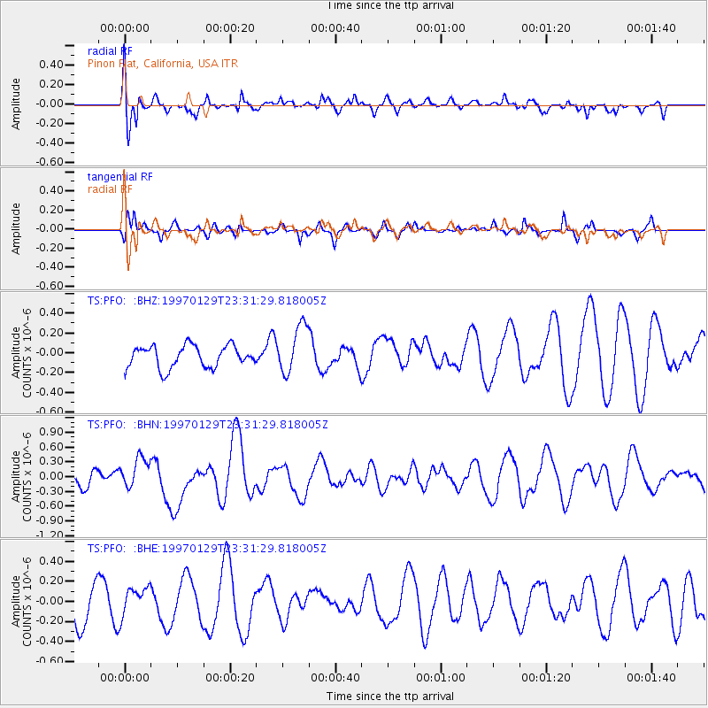
PFO Pinon Flat, California, USA - Earthquake Result Viewer
*The percent match for this event was below the threshold and hence no stack was calculated.
| Earthquake location: |
Santa Cruz Islands |
| Earthquake latitude/longitude: |
-12.9/166.4 |
| Earthquake time(UTC): |
1997/01/29 (029) 23:19:20 GMT |
| Earthquake Depth: |
33 km |
| Earthquake Magnitude: |
5.5 MB, 6.0 MS, 6.2 UNKNOWN, 6.0 MW |
| Earthquake Catalog/Contributor: |
WHDF/NEIC |
|
| Network: |
TS TERRAscope (Southern California Seismic Network) |
| Station: |
PFO Pinon Flat, California, USA |
| Lat/Lon: |
33.61 N/116.46 W |
| Elevation: |
1280 m |
|
| Distance: |
86.6 deg |
| Az: |
54.597 deg |
| Baz: |
252.241 deg |
| Ray Param: |
$rayparam |
*The percent match for this event was below the threshold and hence was not used in the summary stack. |
|
| Radial Match: |
58.378937 % |
| Radial Bump: |
400 |
| Transverse Match: |
62.03498 % |
| Transverse Bump: |
400 |
| SOD ConfigId: |
4480 |
| Insert Time: |
2010-02-26 14:43:14.662 +0000 |
| GWidth: |
2.5 |
| Max Bumps: |
400 |
| Tol: |
0.001 |
|
Signal To Noise
| Channel | StoN | STA | LTA |
| TS:PFO: :BHN:19970129T23:31:29.818005Z | 1.2652596 | 3.1031294E-7 | 2.4525636E-7 |
| TS:PFO: :BHE:19970129T23:31:29.818005Z | 0.58029354 | 1.348702E-7 | 2.3241721E-7 |
| TS:PFO: :BHZ:19970129T23:31:29.818005Z | 2.2434561 | 2.4625018E-7 | 1.09763754E-7 |
| Arrivals |
| Ps | |
| PpPs | |
| PsPs/PpSs | |


