WDD Wield Dalam, Malta - Earthquake Result Viewer
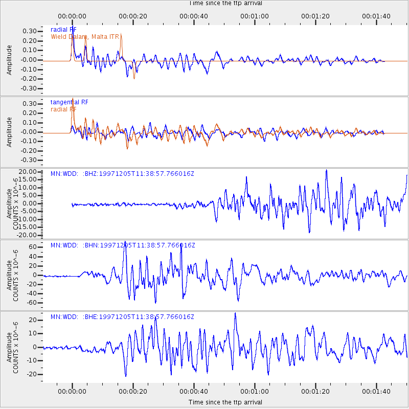
Earthquake location: Near East Coast Of Kamchatka
Earthquake latitude/longitude: 54.8/162.0
Earthquake time(UTC): 1997/12/05 (339) 11:26:54 GMT
Earthquake Depth: 33 km
Earthquake Magnitude: 6.3 MB, 7.6 MS, 7.9 UNKNOWN, 7.3 ME
Earthquake Catalog/Contributor: WHDF/NEIC
Network: MN MEDNET Project
Station: WDD Wield Dalam, Malta
Lat/Lon: 35.87 N/14.52 E
Elevation: 41 m
Distance: 85.4 deg
Az: 334.045 deg
Baz: 18.16 deg
Ray Param: 0.04472092
Estimated Moho Depth: 22.0 km
Estimated Crust Vp/Vs: 1.79
Assumed Crust Vp: 4.05 km/s
Estimated Crust Vs: 2.26 km/s
Estimated Crust Poisson's Ratio: 0.27
Radial Match: 94.648445 %
Radial Bump: 400
Transverse Match: 91.71815 %
Transverse Bump: 400
SOD ConfigId: 4480
Insert Time: 2010-03-08 18:02:28.439 +0000
GWidth: 2.5
Max Bumps: 400
Tol: 0.001

Signal To Noise

ChannelStoNSTALTA
MN:WDD: :BHN:19971205T11:38:57.766016Z7.0976084.2638794E-66.0074876E-7
MN:WDD: :BHE:19971205T11:38:57.766016Z1.7185561.2116294E-67.0502756E-7
MN:WDD: :BHZ:19971205T11:38:57.766016Z1.95488028.249553E-74.2199787E-7
Arrivals
Ps4.3 SECOND
PpPs15 SECOND
PsPs/PpSs19 SECOND